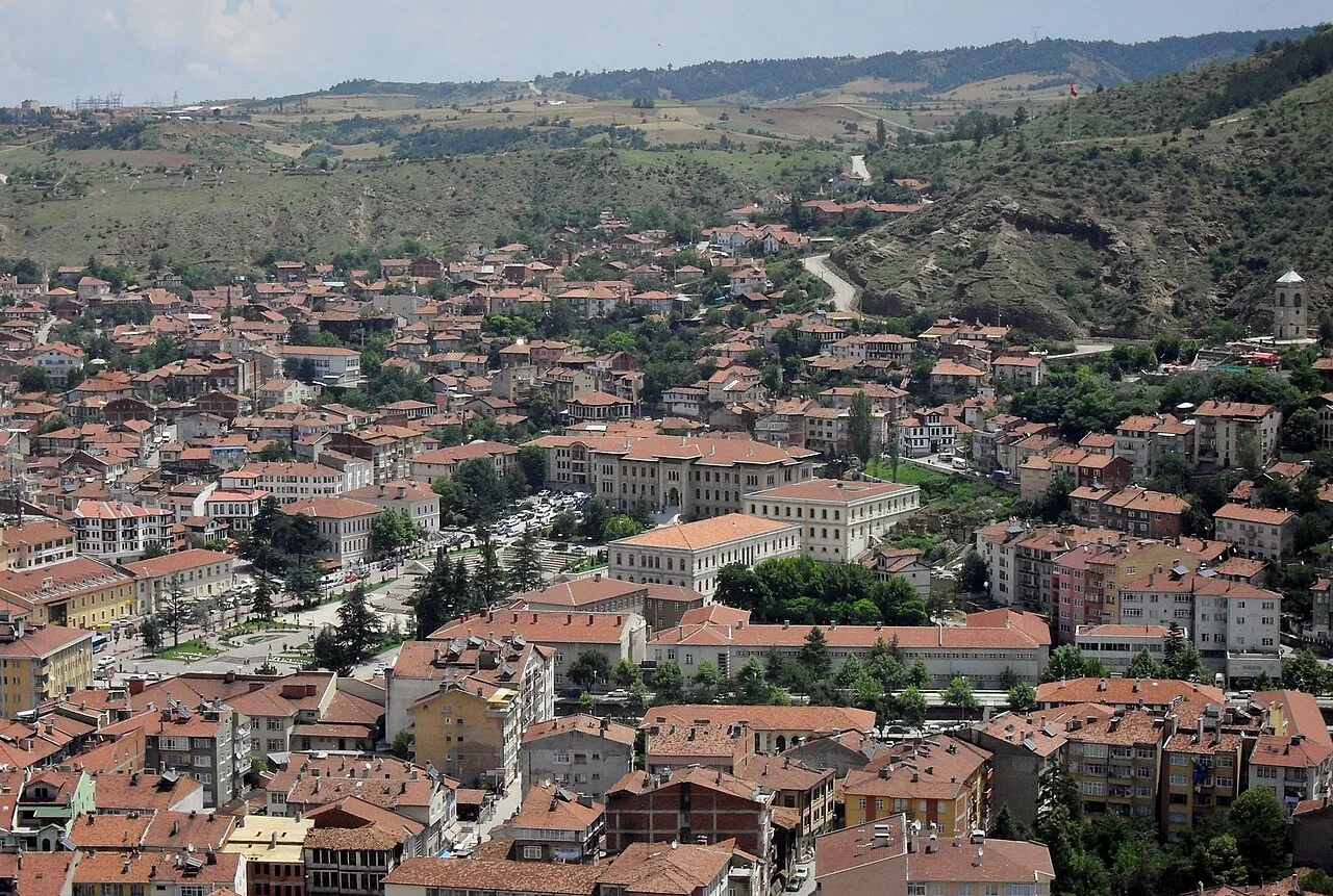
- Population
- 125,622
- 125.6K
- Elevation
- 786 m
- above sea level
- Local time
- UTC+03:00
- Europe/Istanbul · UTC+03:00
- Airports
- KFS Kastamonu Airport7 km
- NOP Sinop Airport129 km
About Kastamonu
Kastamonu is a city. Location: Cide, Kastamonu Province. Population: 125,622. Elevation: 786 m.
Kastamonu is a city in northern Turkey. It is the seat of Kastamonu Province and Kastamonu District. Its population is 125,622 (2021). The city lies at an elevation of 904 m (2,966 ft). It is located in the southern part of the province.
Source: Wikipedia · CC BY-SA 4.0
Photos of Kastamonu
-

Ebarca · CC BY-SA 4.0 -

Hamdigumus · CC0 -

Doğa Aşkınaaa · CC BY-SA 4.0 -

t_e_m_a_s_ · CC BY-SA 3.0 -

t_e_m_a_s_ · CC BY-SA 3.0


Travel notes for Kastamonu
From Wikivoyage
Kastamonu is a city in the Western Karadeniz Region of Turkey. It's 92 km from the Black Sea coast at an altitude of 900 m, and in 2021 had a population of about 125,000.
Understand+
The town may have been founded in the 18th century BC; the Greeks and Romans called it Timonion (Τιμόνιον). It controlled one of the valleys to the Black Sea coast and in the 10th century was fortified by Manuel Erotikos Komnenos (circa 955-1020), so it was dubbed "Kastra Komnenon", hence Kastamonu.
From the 13th to 15th century, Kastamonu was the capital of the Candaroğlu petty kingdom. The Ottomans were already a power in the land, but were almost destroyed by Mongol / Timurid invasion. Thus it was only in 1461 that they'd recovered enough to vanquish the Candaroğlu on their road to establishing an empire on three continents. Kastamonu was thereafter a provincial capital untroubled by warfare. However in the Turkish War of Independence it was a supply hub: western navies embargoed the shipping lanes, but munitions were smuggled into the port of İnebolu, then brought up to Kastamonu, thence to the frontlines.
Get in+
By plane:
1 Kastamonu Airport (KFS IATA) is 12 km south of the city and most days has a flight from Istanbul (IST) by Turkish Airlines, taking 75 min. You'll need a taxi to get downtown.
By bus:
Buses from Istanbul run every 2-3 hours and take 8-9 hours via Gebze, Bolu and Safranbolu, usually continuing via Boyabat to Sinop or Samsun on the coast.
From Ankara six buses a day take four hours. Bus lines on these routes are Metro Turizm and Flixbus.
Local buses ply along the valley from Karabük, which is on the railway from Ankara to Zonguldak, and is close to Safranbolu.
2 Otogar the bus station is 7 km north of city centre. Local buses and dolmuşes run downtown and should be included in your ticket price, check when buying.
By road:
From Istanbul is 510 km: take O-4 / E80 (toll) east past Gerede, then D755 north to Karabük, then D030 east via Araç. The last stretch of road is winding, but is mostly a divided highway.
From Ankara is 240 km: go east on D140 to Kalecik, then north on D765 via Çankırı and Ilgaz. The last section is over the Ilgaz Mountains at 1800 m, so in winter consider the weather outlook. Satnav may try to bring you this way from Istanbul.
Source: Wikivoyage · CC BY-SA 4.0 · abridged
Population of Kastamonu over time
| 2008 | 82,289 | |
|---|---|---|
| 2014 | 137,391 | |
| 2018 | 148,931 | |
| 2021 | 152,541 |
Censuses and official estimates; source: Wikidata.
Climate of Kastamonu
Best months for sightseeingBest months for sightseeing: June, September.
This month · November
A cold month
Day 10° · Night 1° · Rain 38 mm
- Hottest month
- July (day 27°)
- Coldest month
- January (night -4°)
- Wettest month
- May (70 mm)
- Driest month
- September (29 mm)
Bars: average monthly low and high temperature. Below: precipitation. Monthly averages for 1970–2000 at about 18 km resolution, adjusted for elevation. Highlighted months are mild and relatively dry. Source: WorldClim 2.1 (CC BY 4.0).
Show values as a table
| Month | Jan | Feb | Mar | Apr | May | Jun | Jul | Aug | Sep | Oct | Nov | Dec |
|---|---|---|---|---|---|---|---|---|---|---|---|---|
| Average high (°C) | 3° | 6° | 10° | 16° | 20° | 24° | 27° | 27° | 23° | 17° | 10° | 4° |
| Average low (°C) | -4° | -3° | -1° | 4° | 8° | 11° | 13° | 12° | 9° | 5° | 1° | -2° |
| Precipitation (mm) | 45 | 36 | 41 | 58 | 70 | 57 | 37 | 34 | 29 | 45 | 38 | 51 |
How to get to Kastamonu
The nearest airport is Kastamonu Airport (KFS), 7 km to the south as the crow flies. The nearest large city is Karabük, 98 km to the west.
Airports
- Kastamonu Airport (KFS) Kastamonu 7 kmsouth
- Sinop Airport (NOP) Sinop 129 kmnortheast
- Zonguldak Çaycuma Airport (ONQ) Zonguldak 142 kmwest
Nearby large cities
- Karabük Population: 125.4K 98 kmwest
- Çorum Population: 269.6K 135 kmsoutheast
- Zonguldak Population: 101.7K 166 kmwest
- Kirikkale Population: 187K 172 kmsouth
- Çankaya Population: 792.2K 180 kmsouthwest
Straight-line distances; road distances are longer. Airport data: OurAirports.
Day trips from Kastamonu
Within 100 km: 7 historic and cultural sites, 359 natural sites, 202 lakes, rivers and coasts.
0–25 km25 places
- Çiğdem Barajı Lake 24 kmN
- Teke Tepesi Mountain 24 kmE
- Mal Tepesi Mountain 22 kmSW
- Dikmen Tepesi Mountain 16 kmNW
25–60 km195 places
- Terzili Göleti Lake 32 kmN
- Küçüksu Göleti Lake 35 kmE
- Yığınlıçal Tepesi Mountain 50 kmE
- Yayla Tepesi Mountain 43 kmSW
60–100 km348 places
- Sarı Gölü Lake 81 kmS
- Bakkal Gölü Lake 88 kmS
- Sancar Göleti Lake 95 kmSW
- Büyük Göl Lake 77 kmSW
Straight-line distances.
Kastamonu and similar cities
Side by side with cities of similar size in the same country: population, elevation and climate.
| Measure | Kastamonu | Giresun | Derince | Karabük |
|---|---|---|---|---|
| Population | 125.6K | 125.7K | 125.5K | 125.4K |
| Elevation | 786 m | 39 m | 42 m | 316 m |
| Summer day (hottest month) | 27° | 27° | 29° | 29° |
| Winter night (coldest month) | -4° | 4° | 3° | 1° |
| Annual rainfall | 541 mm | 1,058 mm | 727 mm | 733 mm |
| Best months | Jun, Sep | May–Sep | May–Jun, Sep–Oct | May–Jun, Sep–Oct |
| Distance | — | 390 km | 340 km | 98 km |
Climate values are 1970–2000 monthly averages; straight-line distance.
Nearby attractions & nature
Everything nearby-
Tüllü Tepe Mountain, Kastamonu8.4 km NE
-
Gölköy Orman Fidanlığı Natural site, Kastamonu Province7.2 km N
-
Karaçomak Çayı River, Kastamonu Province7.7 km NE
-
Kayalı Tepe Mountain, Kastamonu9.8 km SW
-
Saka Dağı Mountain, Kastamonu17 km W
-
Dikmen Tepesi Mountain, Kastamonu16 km N
-
Dikmen Tepesi Mountain, Kastamonu16 km NW
-
Topçu Tepesi Mountain, Kastamonu15 km S
Sources & licences
Data last updated: · 2 independent sources