Tosya Bucağı
Located in Kastamonu Province, Turkey Coordinates: 41°00′53″ N 34°02′05″ E
- Elevation
- 897 m
- above sea level
- Local time
- UTC+03:00
- Europe/Istanbul · UTC+03:00
- Airports
- KFS Kastamonu Airport39 km
- MZH Amasya Merzifon Airport127 km
About Tosya Bucağı
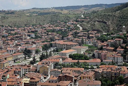
Tosya Bucağı is a municipality. Location: Kastamonu Province, Turkey. Elevation: 897 m. The best months to visit are June, September. The nearest airport is Kastamonu Airport (39 km). Nearby sights include Delik Tepesi and Karakaya Boğazı.
Climate of Tosya Bucağı
Best months for sightseeingBest months for sightseeing: June, September.
This month · November
A cold month
Day 11° · Night 1° · Rain 38 mm
- Hottest month
- July (day 27°)
- Coldest month
- January (night -3°)
- Wettest month
- May (75 mm)
- Driest month
- August (25 mm)
Bars: average monthly low and high temperature. Below: precipitation. Monthly averages for 1970–2000 at about 18 km resolution, adjusted for elevation. Highlighted months are mild and relatively dry. Source: WorldClim 2.1 (CC BY 4.0).
Show values as a table
| Month | Jan | Feb | Mar | Apr | May | Jun | Jul | Aug | Sep | Oct | Nov | Dec |
|---|---|---|---|---|---|---|---|---|---|---|---|---|
| Average high (°C) | 3° | 5° | 10° | 16° | 20° | 24° | 27° | 27° | 23° | 18° | 11° | 5° |
| Average low (°C) | -3° | -3° | 0° | 4° | 8° | 11° | 13° | 13° | 9° | 6° | 1° | -2° |
| Precipitation (mm) | 50 | 42 | 45 | 62 | 75 | 57 | 30 | 25 | 26 | 38 | 38 | 58 |
How to get to Tosya Bucağı
The nearest airport is Kastamonu Airport (KFS), 39 km to the northwest as the crow flies. For international flights: Esenboğa International Airport (ESB) (132 km). The nearest large city is Kastamonu, 46 km to the northwest.
Airports
- Kastamonu Airport (KFS) Kastamonu 39 kmnorthwest
- Amasya Merzifon Airport (MZH) Amasya 127 kmeast
- Esenboğa International Airport (ESB) Ankara 132 kmsouthwest
Nearby large cities
- Kastamonu Population: 125.6K 46 kmnorthwest
- Çorum Population: 269.6K 93 kmsoutheast
- Karabük Population: 125.4K 120 kmwest
- Kirikkale Population: 187K 137 kmsouth
- Amasya Population: 114.9K 157 kmeast
Straight-line distances; road distances are longer. Airport data: OurAirports.
Day trips from Tosya Bucağı
Within 100 km: 66 historic and cultural sites, 383 natural sites, 173 lakes, rivers and coasts.
0–25 km42 places
- Tosya Dağı Mountain 9 kmNW
- Taşlıgöynük Tepesi Mountain 19 kmN
- Namaz Tepesi Mountain 16 kmNE
- Küçükhacet Tepe Mountain 20 kmW
25–60 km166 places
- Sarı Gölü Lake 58 kmSW
- Bakkal Gölü Lake 56 kmSW
- Küçüksu Göleti Lake 48 kmN
- Kuru Göl Lake 51 kmS
60–100 km414 places
- İnandıktepe Historic site 82 kmSW
- Elekçi Gölü Lake 87 kmS
- Terzili Göleti Lake 72 kmN
- Çiğdem Barajı Lake 65 kmN
Straight-line distances.
Nearby attractions & nature
Everything nearby-
Delik Tepesi Mountain, Tosya İlçesi1.7 km S
-
Karakaya Boğazı Natural site, Kastamonu Province6 km SE
-
Deringöz Deresi River, Kastamonu Province5.5 km SE
-
Gölçayı Deresi River, Kastamonu Province6.3 km SE
-
Gavur Deresi River, Kastamonu Province6.5 km E
-
Seki Çayı River, Kastamonu Province6.5 km S
-
Gâvur Dağı Mountain, Tosya İlçesi8.1 km NW
-
Gökceviz Deresi River, Kastamonu Province8.1 km E
Other cities and towns in Kastamonu Province
Sources & licences
Data last updated: