Sanliurfa
Local name: Şanlıurfa
Located in Şanlıurfa Province, Turkey Coordinates: 37°10′01″ N 38°47′38″ E
- Population
- 449,549
- 449.5K
- Elevation
- 528 m
- above sea level
- Local time
- UTC+03:00
- Europe/Istanbul · UTC+03:00
- Airports
- GNY Şanlıurfa GAP Airport32 km
- ADF Adıyaman Airport69 km
About Sanliurfa
Sanliurfa is a city. Location: Şanlıurfa Province, Turkey. Population: 449,549. Elevation: 528 m.
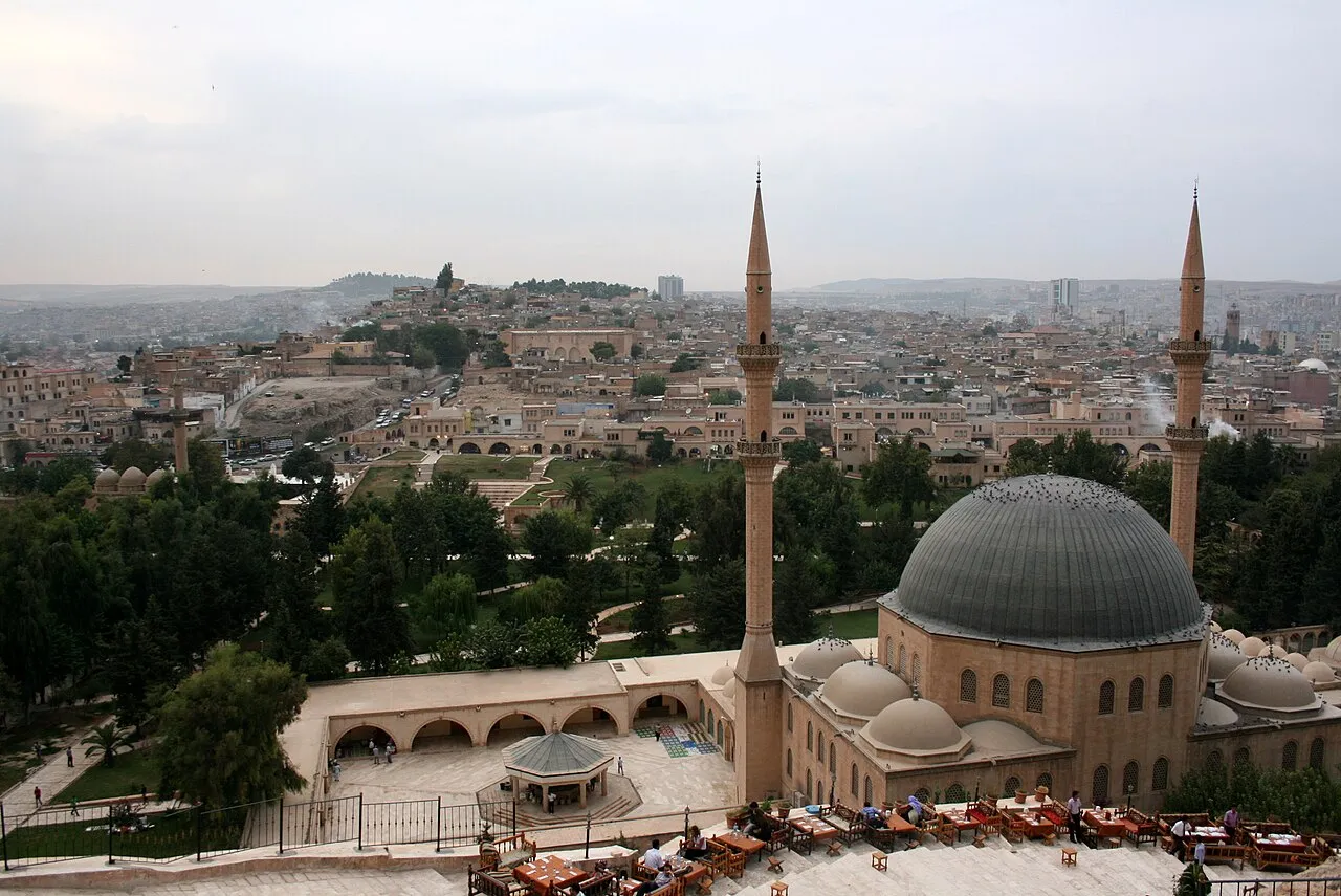
Urfa, officially called Şanlıurfa (Turkish pronunciation: [ʃanˈɫɯuɾfa] lit. 'Urfa the Glorious'), is a city in southeastern Turkey and the capital of Şanlıurfa Province. Urfa is situated on a plain about 80 km (50 mi) east of the Euphrates. Its climate features extremely hot, dry summers and cool, moist winters. About 12 km (7 mi) northeast of the city is the famous Neolithic site of Göbekli Tepe, the world's oldest known temple, which was founded in the 10th millennium BC.
Source: Wikipedia · CC BY-SA 4.0
Photos of Sanliurfa
-

Dosseman · CC BY-SA 4.0 -

Evreka63 · CC BY-SA 4.0 -

Cobija · CC BY-SA 4.0 -

Volker Höhfeld · CC BY-SA 4.0 -

Immanuelle · CC BY-SA 4.0


Travel notes for Sanliurfa
From Wikivoyage
Urfa or Şanlıurfa is a city in Southeastern Anatolia, with a population of 597,000 in 2022. Its main attraction is the holy pool and religious complex associated with the prophet Abraham, a UNESCO World Heritage Site drawing pilgrims and tourists.
Understand+
Urfa stands at a point where the plains of Mesopotamia make an indent into the mountains of Anatolia. So it’s on a trade route and has been settled for thousands of years, with a long list of city names awarded by successive conquerors. Edessa was the name assigned in 303 BC by the Seleucids, meaning abundant water. In 1031 AD it was the last major capture by the declining Byzantines, and its fall in 1144 prompted the Second Crusade (a debacle in the east, though they gained Portugal.) It came under Ottoman control in 1517, by which time Urfa was the city’s usual name. It fell on hard times by 1700, and especially after the Suez Canal opened in 1869, when sea trade supplanted the plod of camels along overland routes.
The popular response to economic decline was to massacre the city’s ethnic minorities, so the Armenian population of 20,000 was slain or deported in a series of atrocities culminating in 1915. Their place was taken by ethnic Turks fleeing from Russian-occupied Armenia. When World War One ended with the defeat of the Ottomans, the initial peace treaty awarded Urfa to French-controlled Syria. A local militia chased out the French occupying forces on 11 April 1920 – that’s 11 Nisan in Turkish, a date commemorated in placenames. The 1923 Treaty of Lausanne re-assigned Urfa to Turkey.
The city of Antep 150 km west was honoured as Gaziantep (Gazi = heroic) for its part in throwing off French occupation, and the citizens of Urfa felt they deserved similar kudos. Their petitioning succeeded in 1984 when it was renamed Şanlıurfa (Şanlı = glorious). So anything official uses that name, while locals still call it Urfa, and others hedge their bets by displaying it as Ş. Urfa.
Tourism and pilgrimage centre on Urfa’s association with the prophet Abraham. The town otherwise makes a living from trades such as shoes and leatherwork, quarrying, and pistachios. It’s also been blighted by the wars in Syria, and has a large refugee population.
Get in+
Most transport websites recognise Urfa as the town name, but a minority insist on Şanlıurfa. The Ş character is seldom available on non-Turkish keyboards, so you have to cut-and-paste.
By plane:
1 Şanlıurfa GAP Airport has several flights a day from Istanbul (both IST and SAW) and daily from Ankara and Izmir. It has the usual facilities including car hire. GAP stands for the southeastern Anatolia irrigation project, and the airport is 36 km north of city centre on D-885 / E99 towards Siverek.
Havaş bus meets all flights and runs downtown, 45 min. Outbound it leaves two hours before flights from opposite Nevali Hotel, 2 km north of Old Town (see Sleep).
By bus:
Urfa is on Highway D-400, which traverses Turkey along the Mediterranean coast then onward to the border with Iran.
Buses from all parts of Turkey run to Gaziantep then continue for two hours to Urfa and then on east towards Diyarbakır and Mardin.
Bus lines are Metroturizm and Kamil Koç, now part of Flixbus.
2 Otogar is the bus station, 2 km north of city centre off Haliliye Blv. The lower deck is for local buses and the upper for long-distance. Exit west to find a dolmuş or taxi to the centre.
Source: Wikivoyage · CC BY-SA 4.0 · abridged
Twin towns and sister cities of Sanliurfa
- Bremerhaven· Germany
Source: Wikidata. Only places with a page on this site are shown.
Population of Sanliurfa over time
| 2009 | 482,323 | |
|---|---|---|
| 2010 | 498,111 | |
| 2011 | 515,199 | |
| 2012 | 526,247 | |
| 2017 | 1,985,753 |
Censuses and official estimates; source: Wikidata.
Climate of Sanliurfa
Best months for sightseeingBest months for sightseeing: April, October.
This month · November
Outside the best season
Day 19° · Night 7° · Rain 52 mm
Better nearby cities in November
- Suruç · 39 km southwest20°
- Viranşehir · 85 km east18°
- Kızıltepe · 158 km east19°
- Hottest month
- July (day 40°)
- Coldest month
- January (night 1°)
- Wettest month
- December (88 mm)
- Driest month
- July (1 mm)
Bars: average monthly low and high temperature. Below: precipitation. Monthly averages for 1970–2000 at about 18 km resolution, adjusted for elevation. Highlighted months are mild and relatively dry. Source: WorldClim 2.1 (CC BY 4.0).
Show values as a table
| Month | Jan | Feb | Mar | Apr | May | Jun | Jul | Aug | Sep | Oct | Nov | Dec |
|---|---|---|---|---|---|---|---|---|---|---|---|---|
| Average high (°C) | 10° | 12° | 17° | 23° | 29° | 35° | 40° | 39° | 35° | 27° | 19° | 12° |
| Average low (°C) | 1° | 2° | 5° | 10° | 15° | 20° | 24° | 24° | 19° | 14° | 7° | 3° |
| Precipitation (mm) | 82 | 72 | 73 | 54 | 34 | 5 | 1 | 1 | 2 | 30 | 52 | 88 |
How to get to Sanliurfa
The nearest airport is Şanlıurfa GAP Airport (GNY), 32 km to the north as the crow flies. The nearest large city is Suruç, 39 km to the southwest.
Airports
- Şanlıurfa GAP Airport (GNY) Şanlıurfa 32 kmnorth
- Adıyaman Airport (ADF) Adıyaman 69 kmnorthwest
- Gaziantep Oğuzeli International Airport (GZT) Gaziantep 119 kmwest
Nearby large cities
- Suruç Population: 101.2K 39 kmsouthwest
- Siverek Population: 175.3K 80 kmnortheast
- Adıyaman Population: 290.9K 81 kmnorthwest
- Viranşehir Population: 154.2K 86 kmeast
- Gaziantep Population: 2.2M 126 kmwest
Straight-line distances; road distances are longer. Airport data: OurAirports.
Day trips from Sanliurfa
Within 100 km: 40 historic and cultural sites, 172 natural sites, 122 lakes, rivers and coasts.
0–25 km26 places
- Kaşmer Dağı Mountain 11 kmNW
- Kara Tepe Mountain 11 kmW
- Gora Khalladzhmansur Mountain 23 kmS
- Çılktaş Tepesi Mountain 20 kmSW
25–60 km101 places
- Atatürk Barajı Lake 50 kmN
- Tektek Dağları Mountain 50 kmE
- Gora Shendzheri Mountain 40 kmS
- Gora Korchik Mountain 30 kmN
60–100 km207 places
- Soydan Sulama Göleti Lake 99 kmNE
- Topraksu Sulama Göleti Lake 85 kmE
- Çataltepe Sulama Göleti Lake 66 kmN
- Mülk Sulama Göleti Lake 64 kmN
Straight-line distances.
Sanliurfa and similar cities
Side by side with cities of similar size in the same country: population, elevation and climate.
| Measure | Sanliurfa | Muratpaşa | Batman | Bornova |
|---|---|---|---|---|
| Population | 449.5K | 450K | 452.2K | 452.5K |
| Elevation | 528 m | 53 m | 540 m | 125 m |
| Summer day (hottest month) | 40° | 36° | 39° | 34° |
| Winter night (coldest month) | 1° | 3° | -1° | 4° |
| Annual rainfall | 494 mm | 741 mm | 629 mm | 714 mm |
| Best months | Apr, Oct | Apr | Apr–May, Oct | Apr–May, Oct |
| Distance | — | 715 km | 222 km | 1,027 km |
Climate values are 1970–2000 monthly averages; straight-line distance.
Nearby attractions & nature
Everything nearby-
Der-Yakup Kilisesi Attraction, Eyyübiye1.9 km S
-
Zülmiye Camii Attraction, Eyyübiye2.4 km S
-
Urfa Kalesi Historic site, Eyyübiye2.6 km S
-
Çayiçi Deresi River, Şanlıurfa Province4.3 km SE
-
Gory Germush Mountain, Şanlıurfa Province7.9 km NE
-
Yanış Tepesi Mountain, Haliliye7.5 km NE
-
Gora Chardak Mountain, Eyyübiye7.1 km SW
-
Karakoyun Deresi River, Şanlıurfa Province8.5 km W
Sources & licences
Data last updated: · 2 independent sources