- Elevation
- 2,678 m
- above sea level
- Local time
- UTC+01:00
- Europe/Ljubljana · UTC+01:00
- Airports
- KLU Klagenfurt Airport57 km
- LJU Ljubljana Jože Pučnik Airport66 km
About Mangrt
Mangrt is a mountain. Location: Slovenia. Elevation: 2,678 m.
Mangart or Mangrt is a mountain in the Julian Alps, located on the border between Italy and Slovenia. With an elevation of 2,679 metres (8,789 ft), it is the fourth-highest peak in Slovenia, after Triglav, Škrlatica and Mali Triglav. It was first climbed in 1794 by the naturalist Franz von Hohenwart. Mangart is also the name of the mountain range between the Koritnica Valley and the Mangart Valley, with the highest peak called Veliki Mangart (Big Mount Mangart).
Source: Wikipedia · CC BY-SA 4.0
At a glance
- Topographic prominence
- 1,066 m
Source: Wikidata
Climate of Mangrt
This month · November
A wet month
Day -5° · Night -12° · Rain 187 mm
- Hottest month
- July (day 10°)
- Coldest month
- January (night -17°)
- Wettest month
- October (189 mm)
- Driest month
- February (84 mm)
Bars: average monthly low and high temperature. Below: precipitation. Monthly averages for 1970–2000 at about 18 km resolution, adjusted for elevation. Highlighted months are mild and relatively dry. Source: WorldClim 2.1 (CC BY 4.0).
Show values as a table
| Month | Jan | Feb | Mar | Apr | May | Jun | Jul | Aug | Sep | Oct | Nov | Dec |
|---|---|---|---|---|---|---|---|---|---|---|---|---|
| Average high (°C) | -9° | -8° | -5° | -2° | 4° | 8° | 10° | 10° | 6° | 1° | -5° | -9° |
| Average low (°C) | -17° | -16° | -14° | -10° | -6° | -2° | 0° | 0° | -3° | -7° | -12° | -16° |
| Precipitation (mm) | 102 | 84 | 120 | 159 | 168 | 186 | 170 | 155 | 178 | 189 | 187 | 132 |
How to get to Mangrt
The nearest airport is Klagenfurt Airport (KLU), 57 km to the northeast as the crow flies. The nearest large city is Klagenfurt, 54 km to the northeast.
Airports
- Klagenfurt Airport (KLU) Klagenfurt am Wörthersee 57 kmnortheast
- Ljubljana Jože Pučnik Airport (LJU) Zgornji Brnik 66 kmeast
- Trieste Airport (TRS) Ronchi dei Legionari/Trieste 70 kmsouth
Nearby large cities
- Klagenfurt Population: 100.3K 54 kmnortheast
- Ljubljana Population: 272.2K 79 kmsoutheast
- Rijeka Population: 108K 138 kmsoutheast
- Graz Population: 303.3K 153 kmnortheast
- Salzburg Population: 157.2K 158 kmnorth
Straight-line distances; road distances are longer. Airport data: OurAirports.
Day trips from Mangrt
Within 100 km: 160 historic and cultural sites, 1,720 natural sites, 478 lakes, rivers and coasts.
0–25 km118 places
- Lake Bohinj Lake 23 kmSE
- Triglav Mountain 16 kmSE
- Rjavina Mountain 18 kmE
- Prestreljenik Mountain 17 kmSW
25–60 km609 places
- Lake Bled Lake 35 kmE
- Porezen Mountain 38 kmSE
- Jelovica Mountain 40 kmSE
- Črna Prst Mountain 30 kmSE
60–100 km1,631 places
- Raša River 72 kmS
- Šmarna gora Mountain 71 kmSE
- Mrzla Gora Mountain 72 kmE
- Hrušica Mountain 77 kmSE
Straight-line distances.
Nearest towns and villages
-
Fusine in Valromana Village, Tarvisio6.3 km N
-
Strmec na Predelu Village, Municipality of Bovec4.3 km SW
-
Rateče Village, Municipality of Kranjska Gora5.6 km NE
-
Cave del Predil Village, Tarvisio6.4 km W
-
Log pod Mangartom Village, Municipality of Bovec6.1 km SW
-
Tarvisio Municipality, Province of Udine8.8 km NW
Nearby attractions & nature
Everything nearby-
Monte Tràunig Mountain, Tarvisio2.3 km NW
-
Jalovec Mountain, Municipality of Bovec3.4 km SE
-
Picco di Mezzodì Mountain, Tarvisio3.6 km N
-
Monte Re Mountain, Tarvisio7.7 km W
-
Vršič Mountain, Municipality of Bovec7.1 km E
-
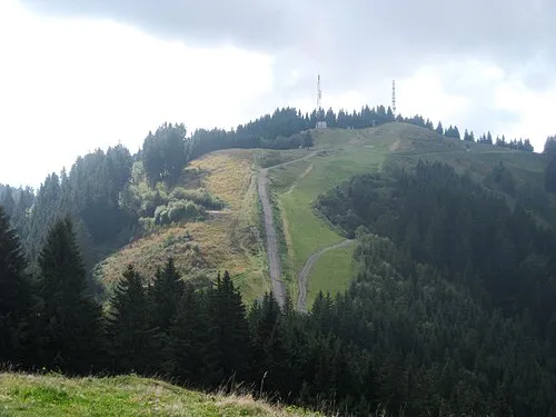 Dreiländereck Mountain, Tarvisio10 km NE
-
Monte Prasnig Mountain, Tarvisio8.3 km NW
-
Prisojnik Mountain, Municipality of Kranjska Gora9.3 km E
Sources & licences
Data last updated: · 2 independent sources