- Elevation
- 1,929 m
- above sea level
- Local time
- UTC+01:00
- Europe/Ljubljana · UTC+01:00
- Airports
- LJU Ljubljana Jože Pučnik Airport29 km
- KLU Klagenfurt Airport35 km
About Olševa
Olševa is a mountain. Location: Municipality of Solčava, Slovenia. Elevation: 1,929 m.
Mount Olševa (pronounced [ˈoːu̯ʃɛʋa]; German Olschewa) is a ridge mountain in the eastern part of the Karawanks near the border with Austria. The mountain separates Carinthia from Styria. Its highest point, Govca, is 1,929 meters (6,329 ft) high. Other peaks along the 5-kilometer (3.1 mi) ridge are Obel kamen on the western side, and Smooth Peak (Gladki vrh) and Pretty Peak (Lepi vrh) on the eastern part.
Source: Wikipedia · CC BY-SA 4.0
Photos of Olševa
-
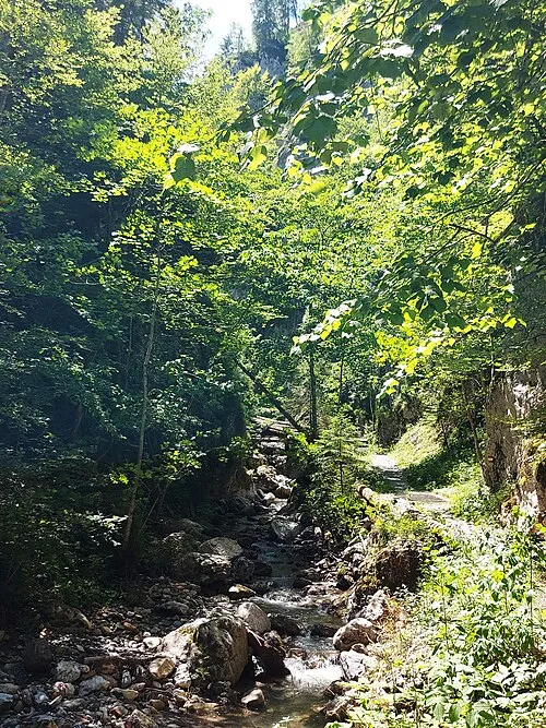
Kupitzklamm Stuhlfauth Thomas · CC BY-SA 4.0

Climate of Olševa
This month · November
A wet month
Day -1° · Night -8° · Rain 153 mm
- Hottest month
- July (day 15°)
- Coldest month
- January (night -13°)
- Wettest month
- June (175 mm)
- Driest month
- January (77 mm)
Bars: average monthly low and high temperature. Below: precipitation. Monthly averages for 1970–2000 at about 18 km resolution, adjusted for elevation. Highlighted months are mild and relatively dry. Source: WorldClim 2.1 (CC BY 4.0).
Show values as a table
| Month | Jan | Feb | Mar | Apr | May | Jun | Jul | Aug | Sep | Oct | Nov | Dec |
|---|---|---|---|---|---|---|---|---|---|---|---|---|
| Average high (°C) | -5° | -3° | 0° | 4° | 9° | 13° | 15° | 15° | 11° | 6° | -1° | -4° |
| Average low (°C) | -13° | -12° | -9° | -6° | -1° | 2° | 4° | 4° | 1° | -3° | -8° | -11° |
| Precipitation (mm) | 77 | 77 | 105 | 129 | 132 | 175 | 157 | 145 | 140 | 146 | 153 | 109 |
How to get to Olševa
The nearest airport is Ljubljana Jože Pučnik Airport (LJU), 29 km to the southwest as the crow flies. The nearest large city is Klagenfurt, 36 km to the northwest.
Airports
- Ljubljana Jože Pučnik Airport (LJU) Zgornji Brnik 29 kmsouthwest
- Klagenfurt Airport (KLU) Klagenfurt am Wörthersee 35 kmnorthwest
- Maribor Edvard Rusjan Airport (MBX) Maribor 77 kmeast
Nearby large cities
- Klagenfurt Population: 100.3K 36 kmnorthwest
- Ljubljana Population: 272.2K 45 kmsouth
- Graz Population: 303.3K 91 kmnortheast
- Zagreb Population: 663.6K 121 kmsoutheast
- Rijeka Population: 108K 124 kmsouth
Straight-line distances; road distances are longer. Airport data: OurAirports.
Day trips from Olševa
Within 100 km: 191 historic and cultural sites, 912 natural sites, 384 lakes, rivers and coasts.
0–25 km140 places
- Mrzla Gora Mountain 11 kmSW
- Grintavec Mountain 14 kmSW
- Kalški Greben Mountain 16 kmSW
- Storžič Mountain 23 kmSW
25–60 km384 places
- Ribnica Lake Lake 45 kmE
- Lake Bled Lake 46 kmW
- Šmarna gora Mountain 38 kmSW
- Krim Mountain 58 kmS
60–100 km963 places
- Raša River 92 kmSW
- Lake Bohinj Lake 65 kmW
- Triglav Mountain 65 kmW
- Veliki Snežnik Mountain 96 kmS
Straight-line distances.
Nearest towns and villages
-
Podolševa Village, Municipality of Solčava1.3 km E
-
Robanov Kot Village, Municipality of Solčava4.8 km S
-
Logarska Dolina Village, Municipality of Solčava5.9 km SW
-
Remschenig Village, Eisenkappel-Vellach5.3 km NW
-
Koprivna Village, Municipality of Črna na Koroškem6.3 km NE
-
Leppen Village, Eisenkappel-Vellach6.8 km NW
Nearby attractions & nature
Everything nearby-
Jawornik Mountain, Eisenkappel-Vellach3.9 km N
-
Spitzberg Mountain, Eisenkappel-Vellach4.5 km N
-
Raduha Mountain, Municipality of Solčava5.4 km E
-
Kupitzklamm Natural site, Carinthia6.3 km NW
-
Sneschnik Mountain, Eisenkappel-Vellach4.7 km N
-
Sneschnik Mountain, Eisenkappel-Vellach4.7 km N
-
Kuratkogel Mountain, Eisenkappel-Vellach4.9 km NW
-
Kukeschhöhe Mountain, Austria5.6 km N
Sources & licences
Data last updated: · 2 independent sources