Campillos
Located in Malaga, Andalusia Coordinates: 37°00′11″ N 4°51′15″ W
- Population
- 8,663
- 8.7K
- Elevation
- 457 m
- above sea level
- Local time
- UTC+01:00
- Europe/Madrid · UTC+01:00
- Places inside
- 3
- listed under Campillos
About Campillos
Campillos is a municipality. Location: Malaga, Andalusia. Population: 8,663. Elevation: 457 m.
Campillos is a municipality and town in the province of Málaga, part of the autonomous community of Andalusia in southern Spain. It is located northwest of the province in the comarca of Guadalteba and within the judicial district of Antequera. The municipality is approximately 30 kilometers from Antequera and 70 from the provincial capital. It covers an area of 188 km2 extending from grain fields and olive groves and includes several lakes inhabited by flamingos and storks.
Read more on Wikipedia Text: Wikipedia contributors · CC BY-SA 4.0 · shortened
At a glance
- Area
- 188 km²
Source: Wikidata
In comparison
- No. 22 of 101 places in Malaga by population
- Nearest larger town: Álora, 23 km SE
- 4 sights and natural places within 10 km Río de la Venta, Río Guadateba
- Listed here: Village: 2, Town: 1
Places in Campillos
3 places-
Campillos Town8K
-
Gobantes Village
-
Peñarrubia Village
Nearby attractions & nature
Everything nearby-
Río de la Venta River, Teba3.3 km SW
-
Río Guadateba River, Antequera4.6 km SW
-
Pantano del Chorro Lake, Antequera6.8 km SE
-
Sierra de la Pizarra Mountain, Ardales12 km SE
-
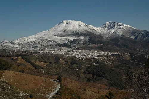 Sierra Prieta Mountain, Casarabonela25 km S
-
Sierra de Huma Mountain, Antequera13 km SE
-
Sierra de Abdalagís Mountain, Antequera13 km SE
-
Sierra de Cañete Mountain, Cañete la Real14 km W
Sources & licences
Data last updated: · 2 independent sources