Casarabonela
Located in Malaga, Andalusia Coordinates: 36°48′06″ N 4°49′45″ W
- Population
- 2,726
- 2.7K
- Elevation
- 555 m
- above sea level
- Local time
- UTC+01:00
- Europe/Madrid · UTC+01:00
- Places inside
- 2
- listed under Casarabonela
About Casarabonela
Casarabonela is a municipality. Location: Malaga, Andalusia. Population: 2,726. Elevation: 555 m.
Casarabonela is a town and municipality in the province of Málaga, part of the autonomous community of Andalusia in southern Spain. The municipality is situated approximately 48 km from Malaga capital (bordering on the regions of Antequera and Ronda). It has a population of approximately 2,500 residents. The natives are called Moriscos.
Read more on Wikipedia Text: Wikipedia contributors · CC BY-SA 4.0 · shortened
At a glance
- Area
- 113 km²
Source: Wikidata
In comparison
- No. 50 of 101 places in Malaga by population
- Nearest larger town: Alora, 11 km E
- 6 sights and natural places within 10 km Sierra Prieta, Sierra de Alcaparaín
- Listed here: Mountain: 1, Village: 1
Places in Casarabonela
2 places-
Casarabonela Village2.5K
-
Sierra Prieta Mountain
Nearby attractions & nature
Everything nearby-
Sierra de Alcaparaín Mountain, Carratraca5.9 km N
-
Sierra de Baños Mountain, Carratraca7.4 km N
-
Arroyo de Corbones River, Burgo, El6.5 km W
-
Sierra de Aguas Mountain, Álora9.1 km NE
-
Sierra de la Pizarra Mountain, Ardales13 km N
-
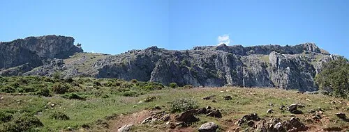 Peñón de Ronda Mountain, Burgo, El17 km SW
-
Castillo de Álora Historic site, Álora11 km E
-
Playa de San Andrés Beach, Alhaurín el Grande16 km SE
Sources & licences
Data last updated: · 2 independent sources