Oliva, La
Located in Las Palmas, Canary Islands Coordinates: 28°41′17″ N 13°55′21″ W
- Population
- 24,079
- 24.1K
- Elevation
- 94 m
- above sea level
- Local time
- UTC+00:00
- Atlantic/Canary · UTC+00:00
- Places inside
- 60
- listed under Oliva, La
About Oliva, La
Oliva, La is a municipality. Location: Las Palmas, Canary Islands. Population: 24,079. Elevation: 94 m.
In comparison
- No. 12 of 34 places in Las Palmas by population
- Nearest larger town: La Oliva, 9 km S
- 37 sights and natural places within 10 km Calderon Hondo, Las Calderas
- Listed here: Beach: 23, Natural site: 10, Village: 8, Mountain: 5
Airports nearest to Oliva, La
- Fuerteventura Airport (FUE) El Matorral 27 km
- César Manrique-Lanzarote Airport (ACE) San Bartolomé 42 km
- Gran Canaria Airport (LPA) Gran Canaria Island 166 km
Straight-line distance; airports with scheduled flights only. Source: OurAirports (public domain).
Places in Oliva, La
60 places-
La Oliva Town25.9K
-
Corralejo Town13.6K
-
El Cotillo Village1.2K
-
Beautiful Sandy Beach Beach
-
Caldereta Village
-
Calderon Hondo Mountain
-
Casa de Los Coroneles Historic site
-
Castillo del Cotillo Historic site
-
Centro Cultural Raíz del Pueblo Attraction
-
Centro de Arte Canario Attraction
-
Centro De Arte Casa Mane Museum
-
Centro de Ocio y Cultura Natural site
-
Corralejo Viejo Beach
-
El Bajo Negro Beach
-
El Charco de Bristol Beach
-
El Veril de Santiago Beach
-
Ermita Nuestra Señora de Puerto Attraction
-
Faro de Punta de Tostón Landmark
-
Faro de Punta Martiño Landmark
-
Iglesia Nuestra Señora de la Candelaria Attraction
-
Islote de Lobos Natural Park Natural site
-
Jable del Moro Natural site
-
Lajares Village
-
Las Calderas Natural site
-
Las Clavellinas Beach
-
Las Lagunitas Natural site
-
Lobos Island Island
-
Los Jablitos Natural site
-
Malpaís de la Arena Natural site
-
Montaña de Escanfraga Mountain
-
Montaña Roja Mountain
-
Montaña Tindaya Mountain
-
Morro del Puerco Mountain
-
Museo de las Tradiciones Museum
-
Museo del Grano La Cilla Museum
-
Parc naturel de Corralejo Natural site
-
Parque Botánico de Corralejo Natural site
-
Parque Holandes Village
-
Playa de la Concha Beach
-
Playa del Águila Beach
-
Playa del Castillo Beach
-
Playa del Moro Beach
-
Playa del Muellito Beach
-
Playa De Los Lagos Beach
-
Playa de los Matos Beach
-
Playa de los Valdivias Beach
-
Playa del Perchel Beach
-
Playa del Pozo Beach
-
Playa de Marfolín Beach
-
Playa de Tebeto Beach
-
Playa La Cabezuela Beach
-
Playa Los Picachos Beach
-
Playa Vista Lobos Beach
-
Roque Village
-
Tindaya Village
-
Tostón Village
-
Valle de Fimapaire Natural site
-
Villaverde Village
Nearby attractions & nature
Everything nearby-
Museo de la Pesca Tradicional Museum, Las Palmas9.4 km W
-
El Cotillo Beach, Las Palmas9.2 km W
-
Monte Muda Mountain, Puerto del Rosario14 km S
-
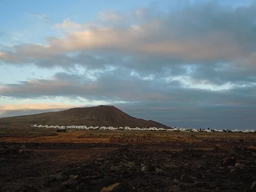 Monte Roja Mountain, Yaiza21 km N
-
Playa Dorada Beach, Las Palmas22 km NE
-
Montaña de Tao Mountain, Puerto del Rosario23 km S
-
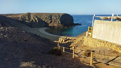 Playa del Papagayo Beach, Yaiza22 km NE
-
Playa Blanca bay Beach, Las Palmas20 km NE
Sources & licences
Data last updated: