- Elevation
- 3,073 m
- above sea level
- Local time
- UTC+01:00
- Europe/Madrid · UTC+01:00
- Airports
- LEU Pirineus - la Seu d'Urgel Airport37 km
- CCF Carcassonne Salvaza Airport97 km
About Pic de Sotllo
Pic de Sotllo is a mountain. Location: Lladorre, Lleida. Elevation: 3,073 m. The nearest airport is Pirineus - la Seu d'Urgel Airport (37 km). Nearby sights include Pic de Montcalm and Pica d'Estats.
Photos of Pic de Sotllo
-
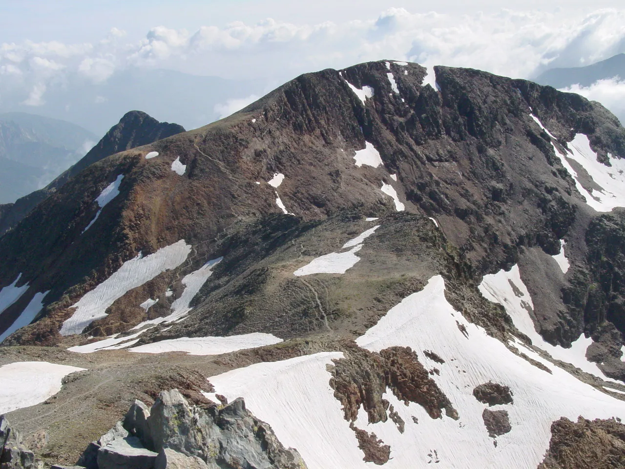
Pic de Montcalm David Edgar · CC BY 2.5

Climate of Pic de Sotllo
This month · November
A wet month
Day -4° · Night -11° · Rain 129 mm
- Hottest month
- July (day 12°)
- Coldest month
- January (night -15°)
- Wettest month
- May (133 mm)
- Driest month
- July (73 mm)
Bars: average monthly low and high temperature. Below: precipitation. Monthly averages for 1970–2000 at about 18 km resolution, adjusted for elevation. Highlighted months are mild and relatively dry. Source: WorldClim 2.1 (CC BY 4.0).
Show values as a table
| Month | Jan | Feb | Mar | Apr | May | Jun | Jul | Aug | Sep | Oct | Nov | Dec |
|---|---|---|---|---|---|---|---|---|---|---|---|---|
| Average high (°C) | -8° | -7° | -4° | -2° | 3° | 7° | 12° | 12° | 8° | 2° | -4° | -6° |
| Average low (°C) | -15° | -14° | -13° | -11° | -7° | -4° | -1° | 0° | -3° | -6° | -11° | -13° |
| Precipitation (mm) | 107 | 99 | 95 | 107 | 133 | 110 | 73 | 88 | 94 | 122 | 129 | 112 |
How to get to Pic de Sotllo
The nearest airport is Pirineus - la Seu d'Urgel Airport (LEU), 37 km to the south as the crow flies. For international flights: Toulouse-Blagnac Airport (TLS) (107 km). The nearest large city is Toulouse, 104 km to the north.
Airports
- Pirineus - la Seu d'Urgel Airport (LEU) La Seu d'Urgell Pyrenees and Andorra 37 kmsouth
- Carcassonne Salvaza Airport (CCF) Carcassonne 97 kmnortheast
- Toulouse-Blagnac Airport (TLS) Toulouse/Blagnac 107 kmnorth
Nearby large cities
- Toulouse Population: 511.7K 104 kmnorth
- Perpignan Population: 110.7K 124 kmeast
- Lleida Population: 140.8K 133 kmsouthwest
- Terrassa Population: 218.5K 133 kmsoutheast
- Sabadell Population: 211.7K 139 kmsoutheast
Straight-line distances; road distances are longer. Airport data: OurAirports.
Day trips from Pic de Sotllo
Within 100 km: 92 historic and cultural sites, 1,710 natural sites, 240 lakes, rivers and coasts.
0–25 km207 places
- Artigue River 22 kmNW
- Pic de la Bassera Mountain 15 kmS
- Pic de Portavera Mountain 23 kmW
- Pic de la Gallina Mountain 18 kmW
25–60 km771 places
- Esglesia de Sant Esteve de Ginast Attraction 59 kmW
- Estany de Travessani Lake 42 kmW
- Estany de Sant Maurici Lake 33 kmW
- Lago Saburó Lake 34 kmSW
60–100 km1,064 places
- Lago de Urdiceto Lake 91 kmW
- Pantà de Sant Antoni Lake 63 kmSW
- Pantà de Terradets Lake 78 kmSW
- Embalse de Plandesain Lake 89 kmW
Straight-line distances.
Nearest towns and villages

Nearby attractions & nature
Everything nearby-
Pic de Montcalm Mountain, Auzat1.6 km E
-
Pica d'Estats Mountain, Auzat0.8 km E
-
Guins de l'Ase Mountain, Lladorre1 km N
-
Pic Rodó de Canalbona Mountain, Alins1.3 km SE
-
Pic dels Estanys Mountain, Lladorre1.4 km W
-
Pic de Canalbona Mountain, Alins2 km SE
-
Pointe du Montcalm Mountain, Auzat2.1 km NE
-
Pic de Baborte Mountain, Alins2.1 km SW
More nature in Spain
-
Pic de Broate Mountain, Lladorre3.5 km NW
-
Cap de Broate Mountain, Lladorre3.2 km NW
-
Pic de Salibarri Mountain, Lladorre3.9 km NW
-
 Pic de Certascan Mountain, Lladorre10 km NW
-
Roca Cigalera Mountain, Lladorre5.1 km SW
-
Tuca de Salibarri Mountain, Lladorre5.1 km NW
Sources & licences
Data last updated: