Alange
Located in Badajoz, Extremadura Coordinates: 38°44′08″ N 6°17′16″ W
- Population
- 1,971
- 2K
- Elevation
- 274 m
- above sea level
- Local time
- UTC+01:00
- Europe/Madrid · UTC+01:00
- Places inside
- 3
- listed under Alange
About Alange
Alange is a municipality. Location: Badajoz, Extremadura. Population: 1,971. Elevation: 274 m.
Alange (Spanish pronunciation: [aˈlaŋxe]) is a municipality located in the province of Badajoz, Extremadura, Spain. As of 2017, the municipality has a population of 1,891 inhabitants. There has been a spa at Alange at least since Roman times when a bathhouse was constructed with separate facilities for men and women. There is a medieval castle (but of Roman origins), located on a hill commanding the Matachel river. It was held by the Order of Santiago from the 1240s, and was abandoned in 1550.
Read more on Wikipedia Text: Wikipedia contributors · CC BY-SA 4.0 · shortened
At a glance
- Area
- 160 km²
Source: Wikidata
In comparison
- No. 70 of 165 places in Badajoz by population
- Nearest larger town: Alange, 7 km NE
- 5 sights and natural places within 10 km Arroyo de Valdemedel, Arroyo de Bonhabal
- Listed here: Village: 2, Lake: 1
Places in Alange
3 places-
Alange Village2K
-
Embalse de Alange Lake
-
Palacio Quemado Village
Nearby attractions & nature
Everything nearby-
Arroyo de Valdemedel River, Mérida0.4 km S
-
Arroyo de Bonhabal River, Mérida2.9 km NW
-
 Estadio Francisco de la Hera Landmark, Almendralejo12 km SW
-
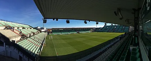 Estadio Romano Landmark, Mérida20 km N
-
Plaza de Toros Attraction, Almendralejo11 km SW
-
Palacio del Vino y la Aceituna Museum, Almendralejo11 km SW
-
Piedad Park Natural site, Almendralejo11 km SW
-
Espolón Natural site, Almendralejo12 km SW
Sources & licences
Data last updated: · 2 independent sources