Herrera de Alcántara
Located in Caceres, Extremadura Coordinates: 39°35′53″ N 7°22′51″ W
- Population
- 292
- 292
- Elevation
- 343 m
- above sea level
- Local time
- UTC+01:00
- Europe/Madrid · UTC+01:00
- Places inside
- 3
- listed under Herrera de Alcántara
About Herrera de Alcántara
Herrera de Alcántara is a municipality. Location: Caceres, Extremadura. Population: 292. Elevation: 343 m.
In comparison
- No. 179 of 222 places in Caceres by population
- Nearest larger town: Cedillo, 9 km NW
- 2 sights and natural places within 10 km Ribera Aurela, Río Alburrel
- Listed here: River: 2, Village: 1
Places in Herrera de Alcántara
3 places-
Herrera de Alcántara Village281
-
Ribera Aurela River
-
Río Alburrel River
Nearby attractions & nature
Everything nearby-
Vale das Favas Natural site, Castelo Branco District11 km N
-
Alto do Corregedor Mountain, Beirã14 km S
-
Sapateira Grande Mountain, Beirã15 km S
-
Cabeço da Aleitosa Mountain, Montalvão14 km W
-
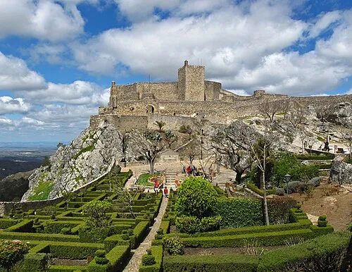 Castelo de Marvão Historic site, Santa Maria de Marvão22 km S
-
Monte da Foz Mountain, Montalvão15 km NW
-
Vale Juncoso Natural site, Castelo Branco District14 km NE
-
Serra de Castelo de Vide Mountain, Portalegre District22 km S
Sources & licences
Data last updated: