Ortigueira
Located in A Coruña, Galicia Coordinates: 43°40′22″ N 7°50′21″ W
- Population
- 6,550
- 6.6K
- Elevation
- 17 m
- above sea level
- Local time
- UTC+01:00
- Europe/Madrid · UTC+01:00
- Places inside
- 34
- listed under Ortigueira
About Ortigueira
Ortigueira is a municipality. Location: A Coruña, Galicia. Population: 6,550. Elevation: 17 m.
Ortigueira is a seaport and municipality in the province of A Coruña the autonomous community of Galicia in northwestern Spain. It belongs to the comarca of Ortegal. It is located on the northern slope of the Serra da Faladoira, the river Mera and on the eastern shore of the Ria de Santa Marta—a winding, rock-bound and much indented inlet of the Bay of Biscay, between Capes Ortegal and Bares, the northernmost headlands of the Peninsula. The town is noted for its romantic surroundings and sea bathing opportunities.
Read more on Wikipedia Text: Wikipedia contributors · CC BY-SA 4.0 · shortened
At a glance
- Area
- 210 km²
Source: Wikidata
In comparison
- No. 38 of 91 places in A Coruña by population
- Nearest larger town: Santa Marta de Ortigueira, 1 km NW
- 10 sights and natural places within 10 km Río das Mestas, Río Seixo
- Listed here: Village: 26, River: 3, Beach: 2, Island: 1
Places in Ortigueira
34 places- 7.7K
-
Mera Village277
-
Ladrido Village170
-
Barbos Village
-
Capelada Village
-
Cape Ortegal Natural site
-
Céltigos Village
-
Couzadoiro Village
-
Couzadoiro Village
-
Cuiña Village
-
Devesos Village
-
Ermo Village
-
Espasante Village
-
Feás Village
-
Freires Village
-
Illa de San Vicente Island
-
Insúa Village
-
Landoi Village
-
Loiba Village
-
Luama Village
-
Luhía Village
-
Mera Village
-
Mosteiro Village
-
Neves Village
-
Pedra Village
-
Praia de Cariño Beach
-
Praia de San Antonio Beach
-
Río de Mera River
-
Río Lourido River
-
Río Seixo River
-
San Claudio Village
-
Senra Village
-
Veiga Village
-
Veiga Village
Nearby attractions & nature
Everything nearby-
Río das Mestas River, Mañón3.5 km NE
-
Río Callobre River, Mañón5.5 km NE
-
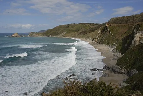 Praia Sarridal Beach, Mañón8.5 km NE
-
Couto de Vilariño Mountain, Mañón8.6 km E
-
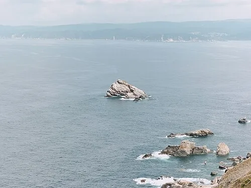 Illa Malveira Island, Cariño10 km N
-
Serra da Faladoira Mountain, Mañón11 km S
-
Río Sor River, Mañón11 km E
-
Illas Gabeiras Island, Cedeira11 km NW
Sources & licences
Data last updated: · 2 independent sources