Triacastela
Located in Lugo, Galicia Coordinates: 42°45′33″ N 7°12′19″ W
- Population
- 756
- 756
- Elevation
- 819 m
- above sea level
- Local time
- UTC+01:00
- Europe/Madrid · UTC+01:00
- Places inside
- 18
- listed under Triacastela
About Triacastela
Triacastela is a municipality. Location: Lugo, Galicia. Population: 756. Elevation: 819 m.
Triacastela is a municipality in the province of Lugo, Galicia, Spain. It gets its name from the three castles that once stood here, none of which exist today. Norman (Viking) invaders pillaged here in 968 A.D., but were eventually defeated at Cebreiro pass and driven off. They probably destroyed all three castles at that time. It is along the French Way route of the Camino de Santiago (The Way of St. James), and many of the pilgrims stop in the town's albergues and restaurants.
Read more on Wikipedia Text: Wikipedia contributors · CC BY-SA 4.0 · shortened
At a glance
- Area
- 51.2 km²
Source: Wikidata
In comparison
- No. 64 of 67 places in Lugo by population
- Nearest larger town: Tríacastela, 3 km W
- 6 sights and natural places within 10 km Pena Soá, Serra do Oribio
- Listed here: Village: 17, Mountain: 1
Places in Triacastela
18 places-
Tríacastela Village826
-
Ramil Village18
-
San Pedro do Ermo Village6
-
A Vila Vella Village
-
Cancelo Village
-
Encrucilladas Village
-
Lamas Village
-
Meizarán Village
-
Monte Village
-
Pasantes Village
-
Pico de Santa Irene Mountain
-
Queijadoiro Village
-
San Salvador Village
-
Santalla Village
-
Teijo Village
-
Toldaos Village
-
Vilar Village
-
Vilavella Village
Nearby attractions & nature
Everything nearby-
Pena Soá Mountain, Samos3.9 km S
-
Serra do Oribio Mountain, Samos4.6 km SW
-
Alto de Torrentes Mountain, Samos5.4 km SW
-
Alto da Forcela Mountain, Láncara5.6 km NW
-
Pico do Polvoreiro Mountain, Samos5.7 km SW
-
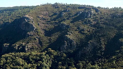 Serra do Courel Mountain, Folgoso do Courel20 km S
-
A Escrita Mountain, Folgoso do Courel12 km S
-
Formigueiros Mountain, Folgoso do Courel19 km SE
Sources & licences
Data last updated: · 2 independent sources