Cerro de la Plata
Located in Segorbe, Castellon Coordinates: 39°46′00″ N 0°26′00″ W
- Elevation
- 388 m
- above sea level
- Local time
- UTC+01:00
- Europe/Madrid · UTC+01:00
About Cerro de la Plata
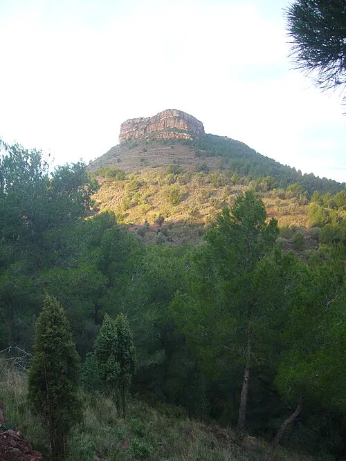
Cerro de la Plata is a mountain. Location: Segorbe, Castellon. Elevation: 388 m.
In comparison
- No. 3149 of 3603 mountains in Spain by elevation
- 12 sights and natural places within 10 km Cruz de la Hoya, Rambla de Almedíjar
Nearest towns and villages
-
Algimia de Alfara Municipality, Valencia4.3 km SE
-
Sot de Ferrer Municipality, Castellon4 km NE
-
Sot de Ferrer Village, Sot de Ferrer4.7 km NE
-
Soneja Village, Soneja5.7 km N
-
Torres Torres Municipality Municipality, Valencia5.9 km SE
-
Algimia de Alfara Village, Algimia de Alfara6 km E
Nearby attractions & nature
Everything nearby-
Cruz de la Hoya Mountain, Segorbe5.7 km NW
-
el Gorgo Mountain, Gátova6.6 km SW
-
El Picacho Mountain, Soneja6.8 km NE
-
El Cierro Mountain, Serra Municipality6.9 km S
-
els Rebalsadors Mountain, Serra Municipality7.7 km S
-
 Mola de Segart Mountain, Segart Municipality11 km SE
-
Alt del Pi Mountain, Serra Municipality8.8 km S
-
Puntal de l'Abella Mountain, Estivella Municipality9.3 km SE
Sources & licences
Data last updated: