Rafelguaraf Municipality
Located in Valencia, Valencia Coordinates: 39°03′04″ N 0°26′35″ W
- Population
- 2,527
- 2.5K
- Elevation
- 51 m
- above sea level
- Local time
- UTC+01:00
- Europe/Madrid · UTC+01:00
- Places inside
- 3
- listed under Rafelguaraf Municipality
About Rafelguaraf Municipality
Rafelguaraf Municipality is a municipality. Location: Valencia, Valencia. Population: 2,527. Elevation: 51 m.
Rafelguaraf (Valencian pronunciation: [raˌfɛlɣwaˈɾaf]) is a municipality in the comarca of Ribera Alta in the Valencian Community, Spain.
Read more on Wikipedia Text: Wikipedia contributors · CC BY-SA 4.0 · shortened
At a glance
- Area
- 16.3 km²
Source: Wikidata
In comparison
- No. 118 of 266 places in Valencia by population
- Nearest larger town: La Pobla Llarga, 4 km NW
- 12 sights and natural places within 10 km Barranco del Pueblo, Río Barcheta
- Listed here: Village: 3
Places in Rafelguaraf Municipality
3 places-
Rafelguaraf Village2.4K
-
Berfull Village1
-
Tosalnou Village
Nearby attractions & nature
Everything nearby-
Barranco del Pueblo River, Alzira4.1 km NW
-
Río Barcheta River, Xàtiva4.1 km SW
-
Parc Navarro Daras Natural site, Carcaixent7.5 km N
-
Teatro Municipal D. Enrique Attraction, Carcaixent7.6 km N
-
Magatzem de Ribera Attraction, Carcaixent7.8 km N
-
Plaza de Toros Attraction, Xàtiva9 km SW
-
Beso Garden Attraction, Xàtiva9.1 km SW
-
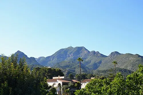 Mondúver Mountain, Xeresa16 km E
Sources & licences
Data last updated: · 2 independent sources