Hjärup
Located in Staffanstorp Municipality, Skåne County Coordinates: 55°40′08″ N 13°08′22″ E
- Population
- 4,744
- 4.7K
- Elevation
- 20 m
- above sea level
- Local time
- UTC+01:00
- Europe/Stockholm · UTC+01:00
About Hjärup
Hjärup is a village. Location: Staffanstorp Municipality, Skåne County. Population: 4,744. Elevation: 20 m.
Hjärup (Swedish pronunciation: [ˈjɛ̌ːrɵp]) is, with its more than 4,250 inhabitants, the second largest locality in Staffanstorp Municipality, Scania, Sweden. Hjärup has a station on the Pågatågen system. The locality has a suburban character with semi-detached houses initially built in the 1960s–1970s on Lundaslätten, the fertile plain south of Lund, initially on land sold off from the farm Hjerup. Hjärup was until the 1990s confined in between the railway and the main road Malmö–Lund.
Read more on Wikipedia Text: Wikipedia contributors · CC BY-SA 4.0 · shortened
At a glance
- Area
- 2.2 km²
Source: Wikidata
In comparison
- No. 4 of 9 places in Staffanstorp Municipality by population
- Nearest larger town: Uppåkra, 2 km E
Nearby attractions & nature
Everything nearby-
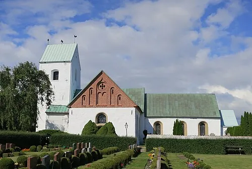 Vellinge kyrka Attraction, Vellinge socken23 km S
-
Dynan Island, Skåne County22 km SW
Sources & licences
Data last updated: · 2 independent sources