Kallhäll
Located in Järfälla Municipality, Stockholm County Coordinates: 59°27′14″ N 17°48′22″ E
- Population
- 13,059
- 13.1K
- Elevation
- 28 m
- above sea level
- Local time
- UTC+01:00
- Europe/Stockholm · UTC+01:00
- Places inside
- 1
- listed under Kallhäll
About Kallhäll
Kallhäll is a municipality. Location: Järfälla Municipality, Stockholm County. Population: 13,059. Elevation: 28 m.
In comparison
- No. 4 of 5 places in Järfälla Municipality by population
- Nearest larger town: Jakobsberg, 4 km SE
- 7 sights and natural places within 10 km Foderholmen, Eldholmen
Places in Kallhäll
1 place-
Kallhäll Village10.2K
Nearby attractions & nature
Everything nearby-
Foderholmen Island, Upplands-Bro Municipality2.8 km SW
-
Eldholmen Island, Kungsängen socken3.9 km SW
-
Askskären Island, Kungsängen socken5.6 km SW
-
 Tensta Konsthall Museum, Stockholm8.6 km SE
-
Lindholm Island, Kungsängen socken8.1 km W
-
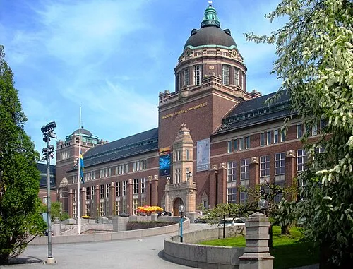 Swedish Museum of Natural History Museum, Stockholm Municipality17 km SE
-
Eldgarnsön Island, Ekerö Municipality9.2 km W
-
Munkholmen Island, Upplands-Bro Municipality8 km N
Sources & licences
Data last updated: