Villberga-Hacksta-Löt
Located in Enköping Municipality, Uppsala County Coordinates: 59°36′45″ N 17°16′40″ E
- Population
- 1,777
- 1.8K
- Elevation
- 26 m
- above sea level
- Local time
- UTC+01:00
- Europe/Stockholm · UTC+01:00
- Places inside
- 3
- listed under Villberga-Hacksta-Löt
About Villberga-Hacksta-Löt
Villberga-Hacksta-Löt is a municipality. Location: Enköping Municipality, Uppsala County. Population: 1,777. Elevation: 26 m.
In comparison
- No. 6 of 36 places in Enköping Municipality by population
- Nearest larger town: Enköping, 11 km W
- 2 sights and natural places within 10 km Grytskär, Näckholm
- Listed here: Village: 3
Airports nearest to Villberga-Hacksta-Löt
- Stockholm Västerås Airport (VST) Stockholm / Västerås 36 km
- Stockholm-Arlanda Airport (ARN) Stockholm 37 km
- Stockholm-Bromma Airport (BMA) Stockholm 47 km
Straight-line distance; airports with scheduled flights only. Source: OurAirports (public domain).
Places in Villberga-Hacksta-Löt
3 places-
Hacksta socken Village
-
Löt socken Village
-
Villberga socken Village
Nearby attractions & nature
Everything nearby-
Grytskär Island, Uppsala County7.6 km SE
-
Näckholm Island, Uppsala County8.6 km SE
-
Myrskär Island, Uppsala County15 km SE
-
Oknön Island, Södermanland County15 km SW
-
Koholmen Island, Uppsala County16 km SW
-
Ytterskär Island, Uppsala County16 km S
-
Innerholm Island, Uppsala County16 km S
-
Granskär Island, Uppsala County16 km S
Other cities and towns in Enköping Municipality
-
Veckholm Municipality, Enköping Municipality11 km S
-
Enköping Municipality, Enköping Municipality11 km W
-
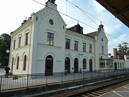 Enköping City, Enköping Municipality12 km W
-
Härkeberga Municipality, Enköping Municipality9.6 km NW
-
Hjälsta Municipality, Enköping Municipality9.9 km NE
-
Södra Åsunda Municipality, Enköping Municipality16 km W
Sources & licences
Data last updated: