Gunnarskär
Located in Västra Götaland County, Sweden Coordinates: 58°17′00″ N 11°21′00″ E
- Elevation
- 1 m
- above sea level
- Local time
- UTC+01:00
- Europe/Stockholm · UTC+01:00
About Gunnarskär
Gunnarskär is an island. Location: Västra Götaland County, Sweden.
In comparison
- 44 sights and natural places within 10 km Borgmästaren, Gråurn
Airports nearest to Gunnarskär
- Trollhättan-Vänersborg Airport (THN) Trollhättan 58 km
- Göteborg Landvetter Airport (GOT) Göteborg 88 km
- Sandefjord Airport, Torp (TRF) Sandefjord(Torp) 119 km
Straight-line distance; airports with scheduled flights only. Source: OurAirports (public domain).
Nearest towns and villages
Nearby attractions & nature
Everything nearby-
Borgmästaren Island, Västra Götaland County0.3 km N
-
Gråurn Island, Västra Götaland County1 km W
-
Klåveskär Island, Västra Götaland County1.1 km NE
-
Kornö Kalv Island, Västra Götaland County2.1 km E
-
Berggylteskär Island, Västra Götaland County2.3 km SE
-
Högholmen Island, Västra Götaland County3.8 km NE
-
Flatholmen Island, Västra Götaland County3.9 km NE
-
Flatholmen Island, Skaftö socken4.3 km SE
More lakes, rivers and coasts in Sweden
-
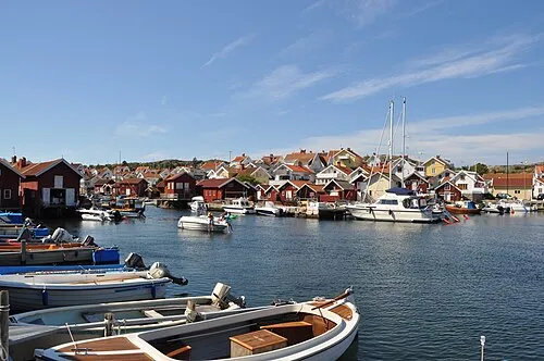 Skaftölandet Island, Västra Götaland County8.1 km SE
-
Bredholmen Island, Västra Götaland County4.3 km S
-
Bockholmen Island, Västra Götaland County4.5 km NE
-
Getholmen Island, Västra Götaland County4.6 km NE
-
Norra Usholmen Island, Västra Götaland County4.7 km SE
-
Långö Island, Västra Götaland County4.2 km SE
Sources & licences
Data last updated: · 2 independent sources