Altels
Located in Kandersteg, Frutigen-Niedersimmental District Coordinates: 46°25′44″ N 7°40′42″ E
- Elevation
- 3,629 m
- above sea level
- Local time
- UTC+01:00
- Europe/Zurich · UTC+01:00
- Airports
- BRN Bern Airport56 km
- LUG Lugano Airport106 km
About Altels
Altels is a mountain. Location: Kandersteg, Frutigen-Niedersimmental District. Elevation: 3,629 m.
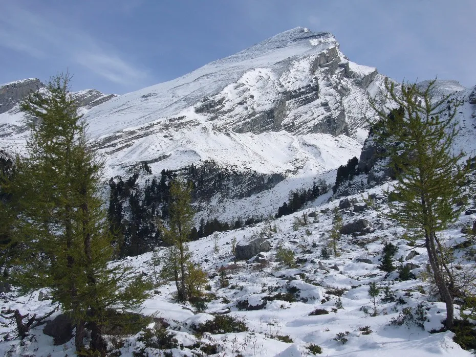
The Altels (3,630 m) is a mountain of the Bernese Alps, located on the border between the Swiss cantons of Bern and Valais. It is situated in the Balmhorn massif, approximately halfway between Kandersteg and Leukerbad. Although its south side is in Valais, the mountain lies within the Aar basin.
Source: Wikipedia · CC BY-SA 4.0
At a glance
- Topographic prominence
- 100 m
Source: Wikidata
Photos of Altels
-

Falk2 · CC BY-SA 4.0 -

Falk2 · CC BY-SA 4.0 -

Björn S · CC BY-SA 2.0 -

Björn S · CC BY-SA 2.0 -

Adrian Michael · CC BY 3.0


Climate of Altels
This month · November
A cold month
Day -8° · Night -14° · Rain 95 mm
- Hottest month
- August (day 4°)
- Coldest month
- February (night -18°)
- Wettest month
- November (95 mm)
- Driest month
- September (75 mm)
Bars: average monthly low and high temperature. Below: precipitation. Monthly averages for 1970–2000 at about 18 km resolution, adjusted for elevation. Highlighted months are mild and relatively dry. Source: WorldClim 2.1 (CC BY 4.0).
Show values as a table
| Month | Jan | Feb | Mar | Apr | May | Jun | Jul | Aug | Sep | Oct | Nov | Dec |
|---|---|---|---|---|---|---|---|---|---|---|---|---|
| Average high (°C) | -12° | -12° | -11° | -9° | -4° | 0° | 3° | 4° | 0° | -4° | -8° | -10° |
| Average low (°C) | -18° | -18° | -17° | -15° | -10° | -7° | -4° | -3° | -6° | -9° | -14° | -16° |
| Precipitation (mm) | 86 | 84 | 89 | 86 | 88 | 87 | 80 | 84 | 75 | 90 | 95 | 90 |
How to get to Altels
The nearest airport is Bern Airport (BRN), 56 km to the north as the crow flies. For international flights: Milan Malpensa International Airport (MXP) (120 km). The nearest large city is Bern, 60 km to the north.
Airports
- Bern Airport (BRN) Bern 56 kmnorth
- Lugano Airport (LUG) Agno 106 kmsoutheast
- Milan Malpensa International Airport (MXP) Ferno (VA) 120 kmsoutheast
Nearby large cities
- Bern Population: 121.6K 60 kmnorth
- Lausanne Population: 139.1K 81 kmwest
- Geneva Population: 201.7K 121 kmwest
- Zurich Population: 415.4K 124 kmnortheast
- Basel Population: 177.6K 126 kmnorth
Straight-line distances; road distances are longer. Airport data: OurAirports.
Day trips from Altels
Within 100 km: 158 historic and cultural sites, 6,026 natural sites, 765 lakes, rivers and coasts.
0–25 km776 places
- Oeschinen Lake Lake 9 kmNE
- Daubensee Lake 5 kmW
- Blausee Lake 12 kmN
- Innersts Seewji Lake 23 kmSE
25–60 km2,821 places
- Strandbad Neuhaus Beach 30 kmN
- Strandbad Manor Farm Beach 30 kmN
- Strandbad Leissigen Beach 26 kmN
- Strandbad Iseltwald Beach 39 kmNE
60–100 km3,352 places
- Kleiner Bremgartenwald Mountain 63 kmN
- Lago Nero Lake 66 kmE
- Sankt Petersinsel Island 82 kmNW
- Isole di Brissago Island 88 kmE
Straight-line distances.
Nearest towns and villages
-
Leukerbad Municipality, Leuk District4.9 km SW
-
Kandersteg Village, Kandersteg7.3 km N
-
Ferden Municipality, Raron District6.3 km SE
-
Fluhalp Village, Leukerbad3.4 km S
-
Leukerbad Village, Leukerbad6.8 km SW
-
Unterbächen Village, Kandersteg5 km NW
Nearby attractions & nature
Everything nearby-
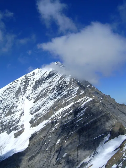 Balmhorn Mountain, Leukerbad1.2 km E
-
Balmhorngletscher Natural site, Kandersteg0.9 km NE
-
Zackengrat Mountain, Leukerbad1.1 km S
-
Schwarzgletscher Natural site, Leukerbad1.2 km SW
-
Obers Tatelishore Mountain, Kandersteg1.6 km N
-
Flüegletscher Natural site, Leukerbad1.7 km SE
-
Gasterespitz Mountain, Kandersteg2.2 km NE
-
Dalagletscher Natural site, Leukerbad2.3 km SE
More nature in Switzerland
-
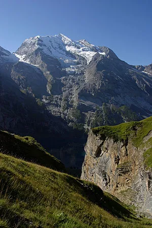 Doldenhorn Mountain, Kandersteg6.2 km NE
-
Unders Tatelishore Mountain, Kandersteg2.6 km N
-
Balme Mountain, Kandersteg2.6 km E
-
Lötschegletscher Natural site, Kandersteg2.5 km E
-
Brandhubel Mountain, Kandersteg3.7 km NE
-
Burstegge Mountain, Kandersteg3.8 km E
Sources & licences
Data last updated: · 2 independent sources