Jungfrau
Located in Lauterbrunnen, Interlaken-Oberhasli District Coordinates: 46°32′12″ N 7°57′45″ E
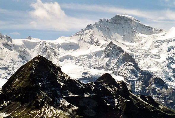
- Elevation
- 4,158 m
- above sea level
- Local time
- UTC+01:00
- Europe/Zurich · UTC+01:00
- Airports
- BRN Bern Airport55 km
- LUG Lugano Airport94 km
About Jungfrau
Jungfrau is a mountain. Location: Lauterbrunnen, Interlaken-Oberhasli District. Elevation: 4,158 m.
The Jungfrau ( YOONG-frow), at 4,158 m (13,642 ft) is one of the main summits of the Bernese Alps, located between the southern canton of Bern and the northern canton of Valais, halfway between Interlaken and Fiesch. Together with the Eiger and Mönch, the Jungfrau forms a massive wall of mountains overlooking the Bernese Oberland and the Swiss Plateau, one of the most distinctive sights of the Swiss Alps.
Source: Wikipedia · CC BY-SA 4.0
At a glance
- Topographic prominence
- 694 m
Source: Wikidata
Photos of Jungfrau
-

Daniel Reust · CC BY-SA 4.0 -

Daniel Reust · CC BY-SA 4.0 -

Andrew Bossi · CC BY-SA 2.5 -

Chris j wood · CC BY-SA 4.0 -

Barbara Steinemann · CC BY-SA 4.0


Climate of Jungfrau
This month · November
A cold month
Day -13° · Night -19° · Rain 95 mm
- Hottest month
- August (day 0°)
- Coldest month
- February (night -22°)
- Wettest month
- June (104 mm)
- Driest month
- September (82 mm)
Bars: average monthly low and high temperature. Below: precipitation. Monthly averages for 1970–2000 at about 18 km resolution, adjusted for elevation. Highlighted months are mild and relatively dry. Source: WorldClim 2.1 (CC BY 4.0).
Show values as a table
| Month | Jan | Feb | Mar | Apr | May | Jun | Jul | Aug | Sep | Oct | Nov | Dec |
|---|---|---|---|---|---|---|---|---|---|---|---|---|
| Average high (°C) | -16° | -16° | -14° | -12° | -7° | -3° | 0° | 0° | -4° | -8° | -13° | -15° |
| Average low (°C) | -22° | -22° | -21° | -19° | -14° | -11° | -8° | -8° | -11° | -14° | -19° | -21° |
| Precipitation (mm) | 83 | 84 | 85 | 88 | 95 | 104 | 98 | 100 | 82 | 93 | 95 | 90 |
How to get to Jungfrau
The nearest airport is Bern Airport (BRN), 55 km to the northwest as the crow flies. For international flights: Zürich Airport (ZRH) (112 km). The nearest large city is Bern, 60 km to the northwest.
Airports
- Bern Airport (BRN) Bern 55 kmnorthwest
- Lugano Airport (LUG) Agno 94 kmsoutheast
- Zürich Airport (ZRH) Zurich 112 kmnortheast
Nearby large cities
- Bern Population: 121.6K 60 kmnorthwest
- Lausanne Population: 139.1K 102 kmwest
- Zurich Population: 415.4K 103 kmnortheast
- Basel Population: 177.6K 117 kmnorth
- Winterthur Population: 111.8K 122 kmnortheast
Straight-line distances; road distances are longer. Airport data: OurAirports.
Day trips from Jungfrau
Within 100 km: 194 historic and cultural sites, 6,718 natural sites, 862 lakes, rivers and coasts.
0–25 km891 places
- Strandbad Neuhaus Beach 19 kmNW
- Strandbad Manor Farm Beach 20 kmNW
- Strandbad Leissigen Beach 20 kmNW
- Strandbad Iseltwald Beach 20 kmN
25–60 km3,197 places
- Lago Nero Lake 45 kmE
- Lago Tremorgio Lake 58 kmE
- Lake Thun Lake 25 kmNW
- Lago Sfundau Lake 44 kmE
60–100 km3,686 places
- Kleiner Bremgartenwald Mountain 63 kmNW
- Arbeiterstrandbad Tennwil Beach 88 kmN
- Ufenau Island 98 kmNE
- Sankt Petersinsel Island 86 kmNW
Straight-line distances.
Nearest towns and villages
-
Stechelberg Village, Lauterbrunnen4.7 km W
-
Mürren Village, Lauterbrunnen5.9 km NW
-
 Wengen Village, Lauterbrunnen8.4 km NW
-
 Trachsellauenen Village, Lauterbrunnen4.6 km W
-
Lauterbrunnen Village, Lauterbrunnen7.5 km NW
-
Gimmelwald Village, Lauterbrunnen5.5 km W
Nearby attractions & nature
Everything nearby-
Wengen Jungfrau Mountain, Lauterbrunnen0.3 km N
-
Hochfirn Natural site, Lauterbrunnen0.4 km W
-
Rottalhorn Mountain, Fieschertal0.6 km SE
-
Silbermulde Natural site, Lauterbrunnen0.8 km NW
-
Chlys Silberhoren Mountain, Lauterbrunnen1 km NW
-
Silberhorn Mountain, Lauterbrunnen1.2 km NW
-
Louwihorn Mountain, Fieschertal1.2 km SE
-
Schneehoren Mountain, Lauterbrunnen1.4 km N
Sources & licences
Data last updated: · 2 independent sources