- Elevation
- 2,928 m
- above sea level
- Local time
- UTC+01:00
- Europe/Zurich · UTC+01:00
- Airports
- LUG Lugano Airport71 km
- ZRH Zürich Airport93 km
About Badus
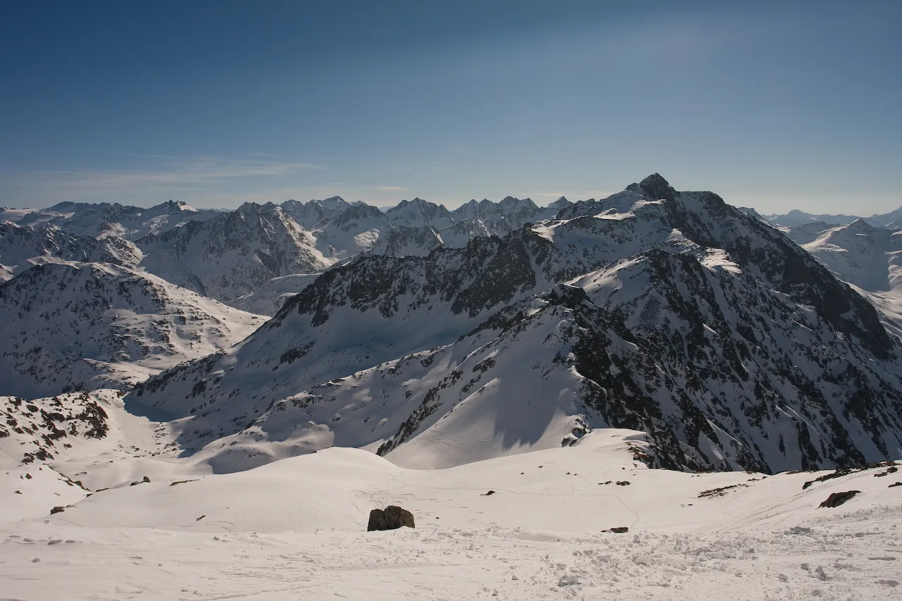
Badus is a mountain. Location: Andermatt, Uri. Elevation: 2,928 m.
Piz Badus or Six Madun is a mountain in the Lepontine Alps, lying on the border between the cantons of Uri and Graubünden. In its northwestern face, which is the Graubünden side, lies Tomasee, source of the Anterior Rhine. It is possible to reach the lake on a path from Oberalp Pass, suitable for most walkers although still a mountain trail.
Source: Wikipedia · CC BY-SA 4.0
At a glance
- Topographic prominence
- 529 m
Source: Wikidata
Photos of Badus
-

Capricorn4049 · CC BY-SA 3.0 -

Capricorn4049 · CC BY-SA 3.0 -

Isjc99 · CC BY-SA 3.0 -

Isjc99 · CC BY-SA 3.0 -

Albinfo · CC BY-SA 3.0


Climate of Badus
This month · November
A wet month
Day -5° · Night -11° · Rain 118 mm
- Hottest month
- July (day 8°)
- Coldest month
- February (night -14°)
- Wettest month
- June (142 mm)
- Driest month
- February (85 mm)
Bars: average monthly low and high temperature. Below: precipitation. Monthly averages for 1970–2000 at about 18 km resolution, adjusted for elevation. Highlighted months are mild and relatively dry. Source: WorldClim 2.1 (CC BY 4.0).
Show values as a table
| Month | Jan | Feb | Mar | Apr | May | Jun | Jul | Aug | Sep | Oct | Nov | Dec |
|---|---|---|---|---|---|---|---|---|---|---|---|---|
| Average high (°C) | -8° | -8° | -7° | -5° | 0° | 4° | 8° | 8° | 4° | 0° | -5° | -7° |
| Average low (°C) | -14° | -14° | -13° | -11° | -6° | -3° | 0° | 0° | -3° | -6° | -11° | -13° |
| Precipitation (mm) | 96 | 85 | 105 | 128 | 134 | 142 | 142 | 141 | 129 | 131 | 118 | 100 |
How to get to Badus
The nearest airport is Lugano Airport (LUG), 71 km to the south as the crow flies. For international flights: Zürich Airport (ZRH) (93 km). The nearest large city is Zurich, 83 km to the north.
Airports
- Lugano Airport (LUG) Agno 71 kmsouth
- Zürich Airport (ZRH) Zurich 93 kmnorth
- Bern Airport (BRN) Bern 95 kmwest
Nearby large cities
- Zurich Population: 415.4K 83 kmnorth
- Winterthur Population: 111.8K 98 kmnorth
- Bern Population: 121.6K 100 kmwest
- Basel Population: 177.6K 133 kmnorthwest
- Lausanne Population: 139.1K 156 kmwest
Straight-line distances; road distances are longer. Airport data: OurAirports.
Day trips from Badus
Within 100 km: 219 historic and cultural sites, 7,128 natural sites, 961 lakes, rivers and coasts.
0–25 km1,112 places
- Lago Nero Lake 21 kmSW
- Lago Tremorgio Lake 17 kmS
- Lago Sfundau Lake 21 kmSW
- Lago del Sambuco Lake 18 kmS
25–60 km3,279 places
- Strandbad Iseltwald Beach 54 kmW
- Strandbad Brienz Beach 49 kmW
- Isole di Brissago Island 55 kmS
- Sant' Apollinare Island 55 kmS
60–100 km3,917 places
- Fahr Abbey Attraction 89 kmN
- Strandbad Neuhaus Beach 65 kmW
- Strandbad Manor Farm Beach 65 kmW
- Strandbad Leissigen Beach 69 kmW
Straight-line distances.
Nearest towns and villages

Nearby attractions & nature
Everything nearby-
Älpetligrat Mountain, Tujetsch0.5 km NW
-
Piz Tuma Mountain, Tujetsch0.8 km NW
-
Piz Tagliola Mountain, Andermatt1 km E
-
Parlet Mountain, Tujetsch1.1 km NW
-
Gloggespitz Mountain, Andermatt1.2 km S
-
Rossbodenstock Mountain, Andermatt1.7 km NW
-
Piz Nair Mountain, Andermatt1.8 km SE
-
Fil Tuma Mountain, Tujetsch1.8 km N
Sources & licences
Data last updated: · 2 independent sources