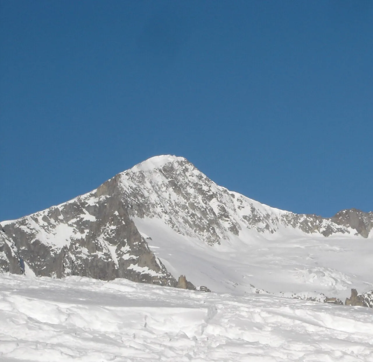
- Elevation
- 3,586 m
- above sea level
- Local time
- UTC+01:00
- Europe/Zurich · UTC+01:00
- Airports
- LUG Lugano Airport78 km
- BRN Bern Airport78 km
About Galenstock
Galenstock is a mountain. Location: Realp, Uri. Elevation: 3,586 m.
The Galenstock (3,586 m) is the fourth highest mountain in the Urner Alps in Switzerland. Its summit ridge lies on the border between the cantons of Uri and the Valais. It was first climbed by Eduard Desor, Daniel Dollfuss Sr., and Daniel Dollfuss Jr., with guides H. Währen, M. Bannholzer, P. Brigger and H. Jaun on 18 August 1845.
Source: Wikipedia · CC BY-SA 4.0
At a glance
- Topographic prominence
- 252 m
Source: Wikidata
Photos of Galenstock
-

Björn S · CC BY-SA 2.0 -

Björn S · CC BY-SA 2.0 -

Coronium · CC BY-SA 3.0 -

Whgler · CC BY 4.0 -

Coronium · CC BY-SA 4.0


Climate of Galenstock
This month · November
A wet month
Day -9° · Night -14° · Rain 104 mm
- Hottest month
- August (day 3°)
- Coldest month
- February (night -18°)
- Wettest month
- July (116 mm)
- Driest month
- February (82 mm)
Bars: average monthly low and high temperature. Below: precipitation. Monthly averages for 1970–2000 at about 18 km resolution, adjusted for elevation. Highlighted months are mild and relatively dry. Source: WorldClim 2.1 (CC BY 4.0).
Show values as a table
| Month | Jan | Feb | Mar | Apr | May | Jun | Jul | Aug | Sep | Oct | Nov | Dec |
|---|---|---|---|---|---|---|---|---|---|---|---|---|
| Average high (°C) | -12° | -12° | -11° | -10° | -5° | -1° | 2° | 3° | 0° | -4° | -9° | -11° |
| Average low (°C) | -17° | -18° | -17° | -15° | -10° | -7° | -4° | -4° | -6° | -9° | -14° | -16° |
| Precipitation (mm) | 91 | 82 | 97 | 106 | 106 | 114 | 116 | 116 | 106 | 107 | 104 | 93 |
How to get to Galenstock
The nearest airport is Lugano Airport (LUG), 78 km to the southeast as the crow flies. For international flights: Zürich Airport (ZRH) (95 km). The nearest large city is Bern, 83 km to the northwest.
Airports
- Lugano Airport (LUG) Agno 78 kmsoutheast
- Bern Airport (BRN) Bern 78 kmnorthwest
- Zürich Airport (ZRH) Zurich 95 kmnorth
Nearby large cities
- Bern Population: 121.6K 83 kmnorthwest
- Zurich Population: 415.4K 84 kmnorth
- Winterthur Population: 111.8K 102 kmnorth
- Basel Population: 177.6K 123 kmnorthwest
- Lausanne Population: 139.1K 137 kmwest
Straight-line distances; road distances are longer. Airport data: OurAirports.
Day trips from Galenstock
Within 100 km: 215 historic and cultural sites, 6,947 natural sites, 943 lakes, rivers and coasts.
0–25 km1,192 places
- Lago Nero Lake 20 kmSE
- Lago Sfundau Lake 18 kmSE
- Lago Ritom Lake 22 kmE
- Oberalpsee Lake 20 kmE
25–60 km3,167 places
- Strandbad Neuhaus Beach 47 kmW
- Strandbad Manor Farm Beach 47 kmW
- Strandbad Leissigen Beach 50 kmW
- Strandbad Iseltwald Beach 36 kmW
60–100 km3,746 places
- Kleiner Bremgartenwald Mountain 85 kmNW
- Fahr Abbey Attraction 88 kmN
- Arbeiterstrandbad Tennwil Beach 78 kmN
- Ufenau Island 73 kmN
Straight-line distances.
Nearest towns and villages
-
Tiefenbach Village, Realp4.1 km SE
-
Göschenen Municipality, Uri8.5 km NE
-
Innertkirchen Municipality, Interlaken-Oberhasli District9.4 km NW
-
Obergoms Municipality, Goms District9.5 km S
-
Realp Village, Realp6.8 km E
-
Göscheneralp Village, Göschenen6.6 km NE
Nearby attractions & nature
Everything nearby-
Tiefengletscher Natural site, Realp1.1 km E
-
Gross Bielenhorn Mountain, Realp1.3 km SE
-
Sidelengletscher Natural site, Realp1.3 km S
-
Dammazwillinge Mountain, Realp1.6 km NE
-
Sidelenhorn Mountain, Realp1.6 km SW
-
Tiefenstock Mountain, Göschenen1.7 km N
-
Gletschhorn Mountain, Realp1.9 km NE
-
Gross Furkahorn Mountain, Realp1.9 km S
Sources & licences
Data last updated: · 2 independent sources