Gummfluh
Located in Rougemont, Riviera-Pays-d'Enhaut District Coordinates: 46°26′26″ N 7°11′42″ E
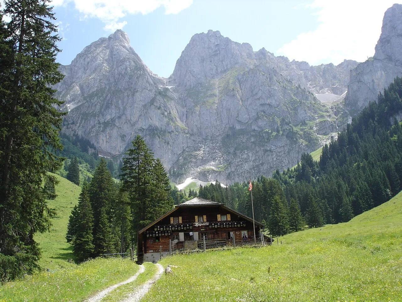
- Elevation
- 2,457 m
- above sea level
- Local time
- UTC+01:00
- Europe/Zurich · UTC+01:00
- Airports
- BRN Bern Airport57 km
- GVA Geneva International Airport87 km
About Gummfluh
Gummfluh is a mountain. Location: Rougemont, Riviera-Pays-d'Enhaut District. Elevation: 2,457 m.
The Gummfluh is a mountain in the western Bernese Alps, located on the border between the Swiss cantons of Vaud and Berne. It is the highest peak in the chain of mountains on the south side of the Pays d'Enhaut and it lies approximately halfway between Château d'Oex and Gstaad. The northern slopes form part of the large nature reserve of La Pierreuse.
Source: Wikipedia · CC BY-SA 4.0
At a glance
- Topographic prominence
- 575 m
Source: Wikidata
Photos of Gummfluh
-

Björn S · CC BY-SA 2.0 -

Björn S · CC BY-SA 2.0 -

Falk2 · CC BY-SA 4.0 -

Falk2 · CC BY-SA 4.0 -

Jérémy Toma · CC BY-SA 4.0


Climate of Gummfluh
This month · November
A wet month
Day -2° · Night -8° · Rain 128 mm
- Hottest month
- August (day 12°)
- Coldest month
- February (night -12°)
- Wettest month
- December (139 mm)
- Driest month
- September (89 mm)
Bars: average monthly low and high temperature. Below: precipitation. Monthly averages for 1970–2000 at about 18 km resolution, adjusted for elevation. Highlighted months are mild and relatively dry. Source: WorldClim 2.1 (CC BY 4.0).
Show values as a table
| Month | Jan | Feb | Mar | Apr | May | Jun | Jul | Aug | Sep | Oct | Nov | Dec |
|---|---|---|---|---|---|---|---|---|---|---|---|---|
| Average high (°C) | -6° | -5° | -3° | 0° | 5° | 8° | 12° | 12° | 8° | 4° | -2° | -5° |
| Average low (°C) | -12° | -12° | -10° | -8° | -3° | 0° | 2° | 3° | 0° | -3° | -8° | -11° |
| Precipitation (mm) | 124 | 129 | 102 | 102 | 110 | 117 | 103 | 105 | 89 | 111 | 128 | 139 |
How to get to Gummfluh
The nearest airport is Bern Airport (BRN), 57 km to the northeast as the crow flies. For international flights: Geneva International Airport (GVA) (87 km). The nearest large city is Lausanne, 44 km to the west.
Airports
- Bern Airport (BRN) Bern 57 kmnortheast
- Geneva International Airport (GVA) Geneva 87 kmwest
- Annecy Meythet airport (NCY) Annecy 102 kmsouthwest
Nearby large cities
- Lausanne Population: 139.1K 44 kmwest
- Bern Population: 121.6K 60 kmnorth
- Geneva Population: 201.7K 85 kmwest
- Besançon Population: 128.4K 127 kmnorthwest
- Basel Population: 177.6K 128 kmnorth
Straight-line distances; road distances are longer. Airport data: OurAirports.
Day trips from Gummfluh
Within 100 km: 149 historic and cultural sites, 4,721 natural sites, 586 lakes, rivers and coasts.
0–25 km572 places
- Ile de Salagnon Island 24 kmW
- Lac de Derborence Lake 18 kmS
- Arnensee Lake 6 kmS
- Lauenensee Lake 12 kmSE
25–60 km2,184 places
- Strandbad Neuhaus Beach 55 kmNE
- Strandbad Manor Farm Beach 54 kmNE
- Strandbad Leissigen Beach 50 kmNE
- Ile d'Ogoz Island 30 kmN
60–100 km2,700 places
- Kleiner Bremgartenwald Mountain 62 kmN
- Strandbad Iseltwald Beach 67 kmNE
- Strandbad Brienz Beach 74 kmNE
- Sankt Petersinsel Island 70 kmN
Straight-line distances.
Nearest towns and villages
-
Rougemont Village, Rougemont5.4 km N
-
Château-d'Oex Municipality, Riviera-Pays-d'Enhaut District6.5 km W
-
Rodosex Dessous Neighbourhood, Château-d'Oex2.8 km NW
-
Chateau-d'Oex Village, Château-d'Oex6.2 km NW
-
Rodosex Dessus Neighbourhood, Château-d'Oex3.1 km NW
-
Ciernes Audron Neighbourhood, Rougemont4 km N
Nearby attractions & nature
Everything nearby-
Pointe de Tso y Bots Mountain, Château-d'Oex0.3 km N
-
Brecaca Mountain, Château-d'Oex0.4 km W
-
Ptes. de Sur Combe Mountain, Rougemont0.5 km E
-
Pointe de la Videman Mountain, Château-d'Oex0.7 km N
-
Le Gras Mountain, Château-d'Oex0.9 km S
-
Sur les Eaux Mountain, Château-d'Oex0.9 km SW
-
Höje Stand Mountain, Château-d'Oex1 km S
-
Le Biolet Mountain, Château-d'Oex1.3 km W
Sources & licences
Data last updated: · 2 independent sources