Pizzo Campo Tencia
Located in Faido, Leventina District Coordinates: 46°25′47″ N 8°43′33″ E
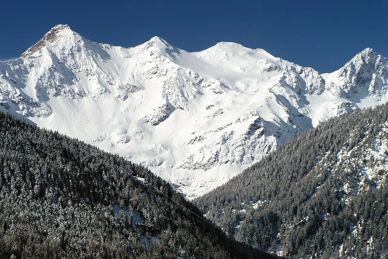
- Elevation
- 3,071 m
- above sea level
- Local time
- UTC+01:00
- Europe/Zurich · UTC+01:00
- Airports
- LUG Lugano Airport49 km
- MXP Milan Malpensa International Airport89 km
About Pizzo Campo Tencia
Pizzo Campo Tencia is a mountain. Location: Faido, Leventina District. Elevation: 3,071 m.
Pizzo Campo Tencia (or Campo Tencia) is a mountain in the Lepontine Alps, which lies in the canton of Ticino, Switzerland. Pizzo Campo Tencia is the highest peak located entirely inside the canton. The mountain lies south of Lago di Morghirolo, between the Valle Leventina and Valle Maggia.
Source: Wikipedia · CC BY-SA 4.0
At a glance
- Topographic prominence
- 754 m
Source: Wikidata
Photos of Pizzo Campo Tencia
-

TheRedBaum · CC BY-SA 4.0 -

book author Douglas William Freshfield · Public domain -

Zacharie Grossen · CC BY-SA 3.0 -

Jo in Riederalp · CC BY-SA 3.0 -

Günter Seggebäing · CC BY-SA 2.5


Climate of Pizzo Campo Tencia
This month · November
A wet month
Day -5° · Night -12° · Rain 111 mm
- Hottest month
- July (day 7°)
- Coldest month
- February (night -15°)
- Wettest month
- June (146 mm)
- Driest month
- February (73 mm)
Bars: average monthly low and high temperature. Below: precipitation. Monthly averages for 1970–2000 at about 18 km resolution, adjusted for elevation. Highlighted months are mild and relatively dry. Source: WorldClim 2.1 (CC BY 4.0).
Show values as a table
| Month | Jan | Feb | Mar | Apr | May | Jun | Jul | Aug | Sep | Oct | Nov | Dec |
|---|---|---|---|---|---|---|---|---|---|---|---|---|
| Average high (°C) | -8° | -8° | -6° | -4° | 0° | 4° | 7° | 7° | 4° | -1° | -5° | -7° |
| Average low (°C) | -15° | -15° | -14° | -11° | -7° | -4° | -1° | -1° | -4° | -8° | -12° | -14° |
| Precipitation (mm) | 86 | 73 | 96 | 129 | 143 | 146 | 141 | 145 | 138 | 137 | 111 | 88 |
How to get to Pizzo Campo Tencia
The nearest airport is Lugano Airport (LUG), 49 km to the south as the crow flies. For international flights: Milan Malpensa International Airport (MXP) (89 km). The nearest large city is Zurich, 105 km to the north.
Airports
- Lugano Airport (LUG) Agno 49 kmsouth
- Milan Malpensa International Airport (MXP) Ferno (VA) 89 kmsouth
- Bern Airport (BRN) Bern 108 kmnorthwest
Nearby large cities
- Zurich Population: 415.4K 105 kmnorth
- Bern Population: 121.6K 114 kmnorthwest
- Winterthur Population: 111.8K 120 kmnorth
- Basel Population: 177.6K 153 kmnorthwest
- Lausanne Population: 139.1K 161 kmwest
Straight-line distances; road distances are longer. Airport data: OurAirports.
Day trips from Pizzo Campo Tencia
Within 100 km: 150 historic and cultural sites, 7,008 natural sites, 912 lakes, rivers and coasts.
0–25 km770 places
- Lago Nero Lake 14 kmW
- Lago Tremorgio Lake 5 kmN
- Lago Sfundau Lake 16 kmW
- Lago del Sambuco Lake 6 kmNW
25–60 km3,102 places
- Isole di Brissago Island 33 kmS
- Sant' Apollinare Island 33 kmS
- San Pancrazio Island 33 kmS
- Neptun-Inseln Island 52 kmN
60–100 km4,198 places
- Strandbad Neuhaus Beach 75 kmW
- Strandbad Manor Farm Beach 75 kmW
- Strandbad Leissigen Beach 78 kmW
- Strandbad Iseltwald Beach 66 kmNW
Straight-line distances.
Nearest towns and villages
Nearby attractions & nature
Everything nearby-
Ghiacciaio Grande di Croslina Natural site, Faido0.4 km NE
-
Pizzo Croslina Mountain, Lavizzara0.7 km NW
-
Pizzo Penca Mountain, Faido1 km E
-
Ghiacciaio Piccolo di Croslina Natural site, Faido0.9 km N
-
Tre Corni Mountain, Lavizzara1.5 km NW
-
Pizzo di Sovèltra Mountain, Faido1.7 km SE
-
Pizzo Canà Mountain, Lavizzara1.7 km NW
-
Val Prato Natural site, Italy2.5 km SW
Sources & licences
Data last updated: · 2 independent sources