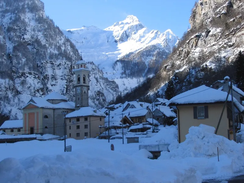
- Elevation
- 2,735 m
- above sea level
- Local time
- UTC+01:00
- Europe/Zurich · UTC+01:00
- Airports
- LUG Lugano Airport42 km
- MXP Milan Malpensa International Airport80 km
About Monte Zucchero
Monte Zucchero is a mountain. Location: Verzasca, Locarno District. Elevation: 2,735 m.
Monte Zucchero (Italian: [ˈmonte dˈdzukkero, - tˈtsuk-]; Ticinese: Zuccar [ˈtsykar]) is a mountain in the Lepontine Alps of Switzerland, located between Bignasco and Sonogno in the canton of Ticino. Reaching a height of 2,735 metres above sea level, Monte Zucchero is the highest summit on the range south of the Passo di Redorta, that separates the Valle Maggia from the Valle Verzasca.
Source: Wikipedia · CC BY-SA 4.0
At a glance
- Topographic prominence
- 554 m
Source: Wikidata
Photos of Monte Zucchero
-

Shesmax · CC BY-SA 4.0 -

Adrian Michael · CC BY 2.5 -

Hans Braxmeier · CC0 -

Shesmax · CC BY-SA 4.0 -

Claudio Vosti · CC BY-SA 2.0


Climate of Monte Zucchero
This month · November
A wet month
Day -3° · Night -10° · Rain 111 mm
- Hottest month
- July (day 9°)
- Coldest month
- February (night -13°)
- Wettest month
- June (146 mm)
- Driest month
- February (73 mm)
Bars: average monthly low and high temperature. Below: precipitation. Monthly averages for 1970–2000 at about 18 km resolution, adjusted for elevation. Highlighted months are mild and relatively dry. Source: WorldClim 2.1 (CC BY 4.0).
Show values as a table
| Month | Jan | Feb | Mar | Apr | May | Jun | Jul | Aug | Sep | Oct | Nov | Dec |
|---|---|---|---|---|---|---|---|---|---|---|---|---|
| Average high (°C) | -6° | -6° | -4° | -2° | 3° | 6° | 9° | 9° | 6° | 2° | -3° | -5° |
| Average low (°C) | -13° | -13° | -12° | -9° | -5° | -1° | 1° | 1° | -2° | -5° | -10° | -12° |
| Precipitation (mm) | 86 | 73 | 96 | 129 | 143 | 146 | 141 | 145 | 138 | 137 | 111 | 88 |
How to get to Monte Zucchero
The nearest airport is Lugano Airport (LUG), 42 km to the south as the crow flies. For international flights: Milan Malpensa International Airport (MXP) (80 km). The nearest large city is Zurich, 113 km to the north.
Airports
- Lugano Airport (LUG) Agno 42 kmsouth
- Milan Malpensa International Airport (MXP) Ferno (VA) 80 kmsouth
- Il Caravaggio International Airport (BGY) Orio al Serio (BG) 108 kmsoutheast
Nearby large cities
- Zurich Population: 415.4K 113 kmnorth
- Bern Population: 121.6K 117 kmnorthwest
- Winterthur Population: 111.8K 128 kmnorth
- Basel Population: 177.6K 160 kmnorthwest
- Lausanne Population: 139.1K 161 kmwest
Straight-line distances; road distances are longer. Airport data: OurAirports.
Day trips from Monte Zucchero
Within 100 km: 132 historic and cultural sites, 6,869 natural sites, 874 lakes, rivers and coasts.
0–25 km637 places
- Lago Nero Lake 17 kmNW
- Isole di Brissago Island 25 kmS
- Sant' Apollinare Island 24 kmS
- San Pancrazio Island 25 kmS
25–60 km2,862 places
- Oberalpsee Lake 34 kmN
- Laghetto di Muzzano Lake 43 kmS
- Lake Lugano Lake 45 kmSE
- Lago di Lucendro Lake 27 kmNW
60–100 km4,376 places
- Strandbad Neuhaus Beach 78 kmNW
- Strandbad Manor Farm Beach 78 kmNW
- Strandbad Leissigen Beach 80 kmNW
- Strandbad Iseltwald Beach 70 kmNW
Straight-line distances.
Nearest towns and villages
Nearby attractions & nature
Everything nearby-
Triangolino Mountain, Verzasca0.6 km N
-
Crestone Mountain, Lavizzara1.3 km NW
-
Pizzo dei Chènt Mountain, Lavizzara1.7 km SW
-
Pizzo Val Mala Mountain, Lavizzara2.3 km W
-
Rasiva Mountain, Verzasca2.4 km SE
-
Larasedo Mountain, Lavizzara2.6 km W
-
Corona di Redòrta Mountain, Lavizzara2.7 km NE
-
Medee di Pietro Mountain, Lavizzara2.9 km W
Sources & licences
Data last updated: · 2 independent sources