- Elevation
- 2,153 m
- above sea level
- Local time
- UTC+01:00
- Europe/Zurich · UTC+01:00
- Airports
- BGY Il Caravaggio International Airport88 km
- BZO Bolzano Airport91 km
About Lagh da Val Viola
Lagh da Val Viola is a lake. Location: Poschiavo, Region Bernina. Elevation: 2,153 m. The nearest airport is Il Caravaggio International Airport (88 km). Nearby sights include Lagh da Scispadus and Lagh dal Dügüral.
Photos of Lagh da Val Viola
-
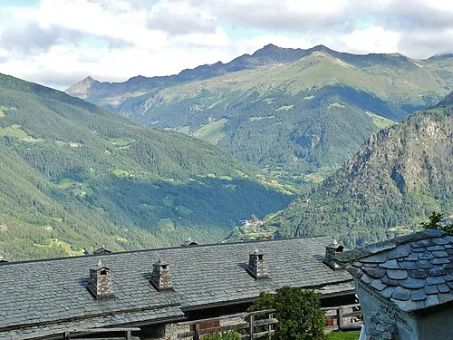
Sasso Campana qwesy qwesy · CC BY 3.0 -
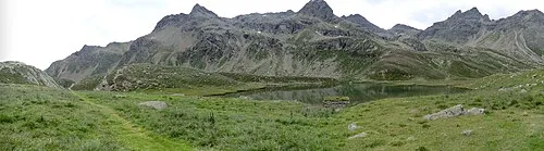
Pizzo Matto Walter Micheletti · CC BY 3.0 -
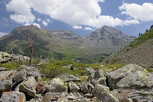
Pizzo di Dosdè Jiří Bubeníček · CC BY-SA 4.0


Climate of Lagh da Val Viola
This month · November
A cold month
Day 0° · Night -7° · Rain 59 mm
- Hottest month
- August (day 13°)
- Coldest month
- February (night -12°)
- Wettest month
- July (86 mm)
- Driest month
- February (40 mm)
Bars: average monthly low and high temperature. Below: precipitation. Monthly averages for 1970–2000 at about 18 km resolution, adjusted for elevation. Highlighted months are mild and relatively dry. Source: WorldClim 2.1 (CC BY 4.0).
Show values as a table
| Month | Jan | Feb | Mar | Apr | May | Jun | Jul | Aug | Sep | Oct | Nov | Dec |
|---|---|---|---|---|---|---|---|---|---|---|---|---|
| Average high (°C) | -4° | -3° | -1° | 1° | 6° | 10° | 13° | 13° | 10° | 6° | 0° | -2° |
| Average low (°C) | -11° | -12° | -9° | -6° | -1° | 2° | 4° | 4° | 2° | -2° | -7° | -10° |
| Precipitation (mm) | 51 | 40 | 52 | 57 | 67 | 82 | 86 | 85 | 74 | 66 | 59 | 52 |
How to get to Lagh da Val Viola
The nearest airport is Il Caravaggio International Airport (BGY), 88 km to the south as the crow flies. The nearest large city is Innsbruck, 135 km to the northeast.
Airports
- Il Caravaggio International Airport (BGY) Orio al Serio (BG) 88 kmsouth
- Bolzano Airport (BZO) Bolzano (BZ) 91 kmeast
- Lugano Airport (LUG) Agno 105 kmsouthwest
Nearby large cities
- Innsbruck Population: 132.5K 135 kmnortheast
- Zurich Population: 415.4K 162 kmnorthwest
- Winterthur Population: 111.8K 163 kmnorthwest
- Bern Population: 121.6K 215 kmwest
- Munich Population: 1.5M 221 kmnortheast
Straight-line distances; road distances are longer. Airport data: OurAirports.
Day trips from Lagh da Val Viola
Within 100 km: 78 historic and cultural sites, 4,845 natural sites, 476 lakes, rivers and coasts.
0–25 km446 places
- Lago di Poschiavo Lake 14 kmS
- Lej Languard Lake 16 kmNW
- Hahnensee Lake 25 kmW
- Lago Bianco Lake 9 kmW
25–60 km1,787 places
- Spadalone Mountain 53 kmSE
- Chaviolas Island 30 kmW
- Lajets Lake 43 kmW
- Silvaplanersee Lake 27 kmW
60–100 km3,166 places
- Dosso Rotondo Mountain 95 kmSE
- Lag Prau Pulté Lake 81 kmNW
- Lago di Luzzone Lake 91 kmW
- Scheubsbach Lake 88 kmNW
Straight-line distances.
Nearest towns and villages


Nearby attractions & nature
Everything nearby-
Lagh da Scispadus Lake, Poschiavo0.8 km W
-
Lagh dal Dügüral Lake, Poschiavo0.8 km NE
-
Moton Mountain, Lombardy1.3 km NE
-
Lagh da Saoseo Lake, Poschiavo1.2 km SW
-
Terri Rossi Mountain, Poschiavo1.5 km S
-
Punta dal Dügüral Mountain, Lombardy2.2 km SE
-
Scima da Saoseo Mountain, Grosio2.6 km SE
-
La Pala Mountain, Lombardy2.6 km NW
Sources & licences
Data last updated: