Chè d'Mot
Located in Samnaun, Region Engiadina Bassa / Val Müstair Coordinates: 46°57′24″ N 10°22′23″ E
- Elevation
- 2,058 m
- above sea level
- Local time
- UTC+01:00
- Europe/Zurich · UTC+01:00
- Airports
- INN Innsbruck Airport81 km
- ACH Sankt Gallen Altenrhein Airport85 km
About Chè d'Mot
Chè d'Mot is a mountain. Location: Samnaun, Region Engiadina Bassa / Val Müstair. Elevation: 2,058 m. The nearest airport is Innsbruck Airport (81 km). Nearby sights include Mot Salatsch and Motta Saltuorn.
Photos of Chè d'Mot
-
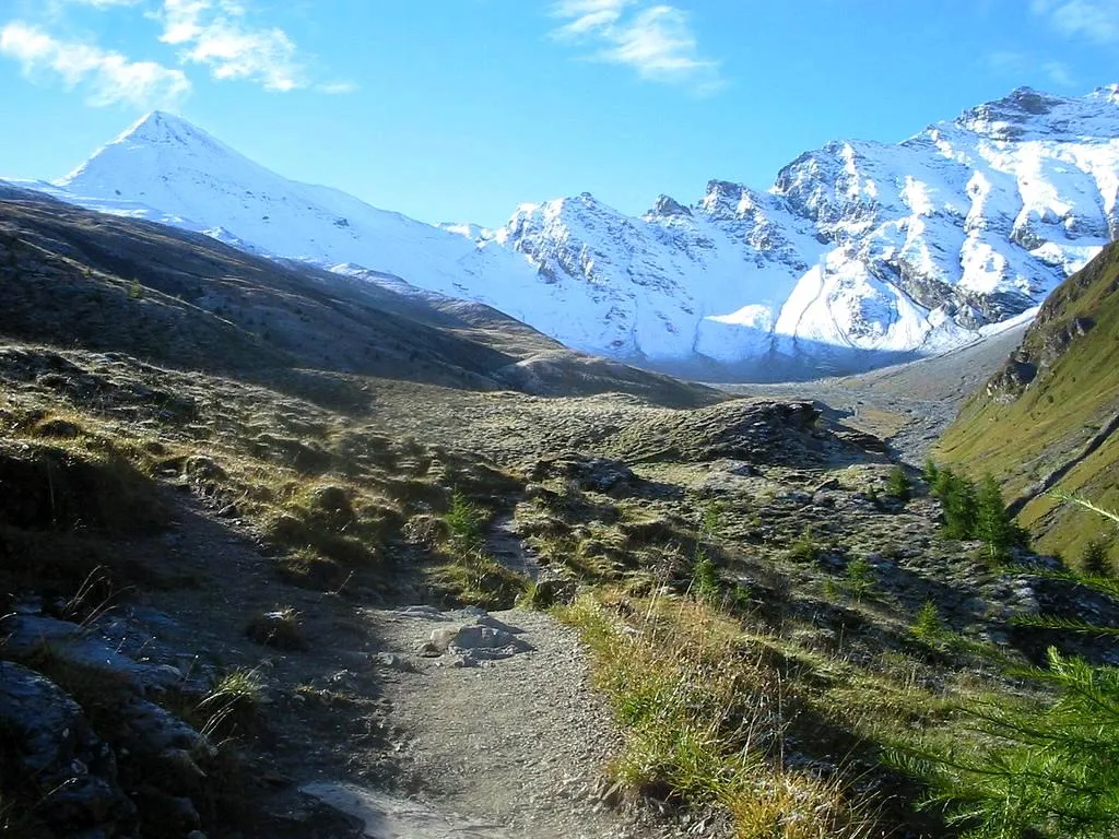
Muttler ZachT · Public domain

Climate of Chè d'Mot
This month · November
A cold month
Day 1° · Night -6° · Rain 72 mm
- Hottest month
- July (day 14°)
- Coldest month
- February (night -10°)
- Wettest month
- July (115 mm)
- Driest month
- February (57 mm)
Bars: average monthly low and high temperature. Below: precipitation. Monthly averages for 1970–2000 at about 18 km resolution, adjusted for elevation. Highlighted months are mild and relatively dry. Source: WorldClim 2.1 (CC BY 4.0).
Show values as a table
| Month | Jan | Feb | Mar | Apr | May | Jun | Jul | Aug | Sep | Oct | Nov | Dec |
|---|---|---|---|---|---|---|---|---|---|---|---|---|
| Average high (°C) | -3° | -2° | 0° | 3° | 8° | 11° | 14° | 14° | 11° | 7° | 1° | -2° |
| Average low (°C) | -10° | -10° | -8° | -5° | 0° | 3° | 5° | 5° | 2° | -1° | -6° | -9° |
| Precipitation (mm) | 64 | 57 | 69 | 73 | 84 | 104 | 115 | 108 | 81 | 69 | 72 | 69 |
How to get to Chè d'Mot
The nearest airport is Innsbruck Airport (INN), 81 km to the northeast as the crow flies. The nearest large city is Innsbruck, 85 km to the northeast.
Airports
- Innsbruck Airport (INN) Innsbruck 81 kmnortheast
- Sankt Gallen Altenrhein Airport (ACH) St. Gallen 85 kmnorthwest
- Bolzano Airport (BZO) Bolzano (BZ) 91 kmsoutheast
Nearby large cities
- Innsbruck Population: 132.5K 85 kmnortheast
- Winterthur Population: 111.8K 139 kmnorthwest
- Zurich Population: 415.4K 146 kmwest
- Munich Population: 1.5M 159 kmnortheast
- Augsburg Population: 301.1K 162 kmnorth
Straight-line distances; road distances are longer. Airport data: OurAirports.
Day trips from Chè d'Mot
Within 100 km: 246 historic and cultural sites, 5,854 natural sites, 1,070 lakes, rivers and coasts.
0–25 km636 places
- Lai Verd Lake 22 kmSW
- Lai da Minschun Lake 18 kmSW
- Lai Blau Lake 22 kmSW
- Lajet da Lischana Lake 23 kmS
25–60 km2,450 places
- Lake Davos Lake 42 kmW
- Gotschnaseeli Lake 42 kmW
- Lai da Juata Lake 36 kmS
- Lai Sura Lake 32 kmSW
60–100 km4,084 places
- Spadalone Mountain 94 kmS
- Chaviolas Island 76 kmSW
- Lajets Lake 79 kmSW
- Walensee Lake 91 kmW
Straight-line distances.
Nearest towns and villages
Nearby attractions & nature
Everything nearby-
Mot Salatsch Mountain, Samnaun0.7 km NE
-
Motta Saltuorn Mountain, Samnaun1 km SE
-
Pendlas Mountain, Samnaun1.3 km W
-
Piz Munschuns Mountain, Samnaun1.5 km N
-
Piz Ot Mountain, Samnaun1.9 km W
-
Salantinas Mountain, Samnaun2 km S
-
Pizzet Mountain, Valsot2 km SE
-
Piz Urezza Mountain, Samnaun2.4 km NE
More nature in Switzerland
-
Muttler Mountain, Samnaun6.2 km S
-
Piz Motnair Mountain, Samnaun2.4 km SE
-
Piz Crappa Grischa Mountain, Samnaun2.5 km W
-
Bieler Mountain, Samnaun2.7 km NE
-
Piler Mountain, Samnaun2.8 km NE
-
Mottals Mountain, Samnaun3 km NE
Sources & licences
Data last updated: