- Elevation
- 3,067 m
- above sea level
- Local time
- UTC+01:00
- Europe/Zurich · UTC+01:00
- Airports
- ACH Sankt Gallen Altenrhein Airport93 km
- BZO Bolzano Airport109 km
About Scalettahorn
Scalettahorn is a mountain. Location: S-chanf, Region Maloja. Elevation: 3,067 m. The nearest airport is Sankt Gallen Altenrhein Airport (93 km). Nearby sights include Vadret Vallorgia and Scalettagletscher.
Photos of Scalettahorn
-
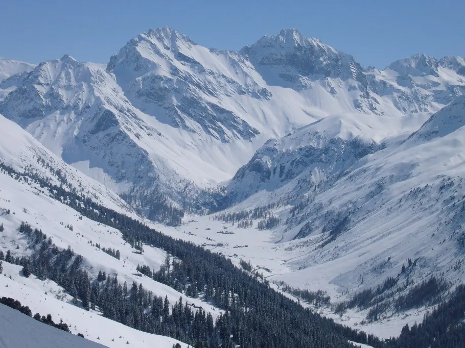
Hoch Ducan Caumasee at de.wikipedia · Public domain

Climate of Scalettahorn
This month · November
A cold month
Day -6° · Night -12° · Rain 96 mm
- Hottest month
- August (day 7°)
- Coldest month
- February (night -17°)
- Wettest month
- July (137 mm)
- Driest month
- February (74 mm)
Bars: average monthly low and high temperature. Below: precipitation. Monthly averages for 1970–2000 at about 18 km resolution, adjusted for elevation. Highlighted months are mild and relatively dry. Source: WorldClim 2.1 (CC BY 4.0).
Show values as a table
| Month | Jan | Feb | Mar | Apr | May | Jun | Jul | Aug | Sep | Oct | Nov | Dec |
|---|---|---|---|---|---|---|---|---|---|---|---|---|
| Average high (°C) | -9° | -9° | -7° | -5° | 0° | 4° | 7° | 7° | 4° | 0° | -6° | -8° |
| Average low (°C) | -17° | -17° | -15° | -12° | -7° | -4° | -2° | -2° | -4° | -7° | -12° | -15° |
| Precipitation (mm) | 87 | 74 | 87 | 90 | 97 | 127 | 137 | 131 | 108 | 92 | 96 | 91 |
How to get to Scalettahorn
The nearest airport is Sankt Gallen Altenrhein Airport (ACH), 93 km to the north as the crow flies. The nearest large city is Innsbruck, 127 km to the northeast.
Airports
- Sankt Gallen Altenrhein Airport (ACH) St. Gallen 93 kmnorth
- Bolzano Airport (BZO) Bolzano (BZ) 109 kmeast
- Lugano Airport (LUG) Agno 110 kmsouthwest
Nearby large cities
- Innsbruck Population: 132.5K 127 kmnortheast
- Winterthur Population: 111.8K 129 kmnorthwest
- Zurich Population: 415.4K 130 kmnorthwest
- Ulm Population: 120.5K 190 kmnorth
- Bern Population: 121.6K 192 kmwest
Straight-line distances; road distances are longer. Airport data: OurAirports.
Day trips from Scalettahorn
Within 100 km: 170 historic and cultural sites, 6,347 natural sites, 802 lakes, rivers and coasts.
0–25 km749 places
- Lej Languard Lake 24 kmS
- Lake Davos Lake 16 kmNW
- Lai Alv Lake 18 kmSW
- Lejs d'Albris Lake 25 kmS
25–60 km2,593 places
- Chaviolas Island 34 kmSW
- Lajets Lake 35 kmSW
- Silvaplanersee Lake 29 kmSW
- Lake Sils Lake 34 kmSW
60–100 km3,977 places
- Spadalone Mountain 86 kmSE
- Walensee Lake 74 kmNW
- Wägitalersee Lake 89 kmNW
- Lago Tremorgio Lake 97 kmW
Straight-line distances.
Nearest towns and villages
Nearby attractions & nature
Everything nearby-
Vadret Vallorgia Natural site, S-chanf0.6 km SE
-
Scalettagletscher Natural site, Davos0.8 km NE
-
Piz Grialetsch Mountain, S-chanf1 km E
-
Chilbiritzenspitz Mountain, Davos1.5 km NE
-
Piz Vadret Mountain, S-chanf1.7 km SE
-
Piz Punt Ota Mountain, S-chanf2.6 km SE
-
Grippa Naira Mountain, Zernez2.8 km E
-
Vadret da Grialetsch Natural site, Zernez2.7 km E
Sources & licences
Data last updated: