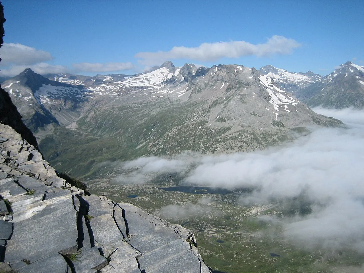
- Elevation
- 3,155 m
- above sea level
- Local time
- UTC+01:00
- Europe/Zurich · UTC+01:00
- Airports
- LUG Lugano Airport55 km
- MXP Milan Malpensa International Airport99 km
About Zapporthorn
Zapporthorn is a mountain. Location: Mesocco, Region Moesa. Elevation: 3,155 m.
The Zapporthorn or Pizzo Zapport (3,152 m) is a mountain of the Swiss Lepontine Alps, overlooking San Bernardino Pass in Graubünden. Its summit is the tripoint between the valleys of Hinterrhein, Calanca and Mesolcina. The summit is located approximately two kilometres east from the Ticino border. The Pizzo Zapport is the highest summit on the Zapportgrat, a ridge running from Piz de Stabi to the Marscholhorn. The Zapportgletscher lies on the north side, it is the largest glacier of the massif.
Source: Wikipedia · CC BY-SA 4.0
At a glance
- Topographic prominence
- 152 m
Source: Wikidata
Photos of Zapporthorn
-

Capricorn4049 · CC BY-SA 4.0 -

Capricorn4049 · CC BY-SA 4.0 -

ISjc99 · CC BY-SA 3.0 -
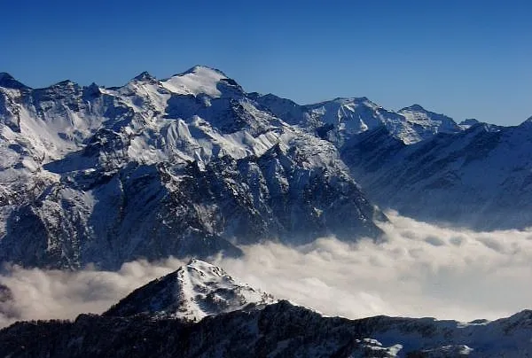
Rheinwaldhorn Aiace · CC BY 2.0 -
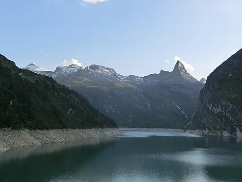
Güferhorn Capricorn4049 · CC BY-SA 3.0


Climate of Zapporthorn
This month · November
A wet month
Day -6° · Night -13° · Rain 115 mm
- Hottest month
- July (day 6°)
- Coldest month
- February (night -16°)
- Wettest month
- September (150 mm)
- Driest month
- February (72 mm)
Bars: average monthly low and high temperature. Below: precipitation. Monthly averages for 1970–2000 at about 18 km resolution, adjusted for elevation. Highlighted months are mild and relatively dry. Source: WorldClim 2.1 (CC BY 4.0).
Show values as a table
| Month | Jan | Feb | Mar | Apr | May | Jun | Jul | Aug | Sep | Oct | Nov | Dec |
|---|---|---|---|---|---|---|---|---|---|---|---|---|
| Average high (°C) | -8° | -9° | -7° | -5° | -1° | 3° | 6° | 6° | 3° | -1° | -6° | -8° |
| Average low (°C) | -16° | -16° | -14° | -12° | -7° | -4° | -2° | -2° | -4° | -8° | -13° | -15° |
| Precipitation (mm) | 92 | 72 | 99 | 133 | 145 | 149 | 147 | 149 | 150 | 143 | 115 | 91 |
How to get to Zapporthorn
The nearest airport is Lugano Airport (LUG), 55 km to the south as the crow flies. For international flights: Milan Malpensa International Airport (MXP) (99 km). The nearest large city is Zurich, 108 km to the northwest.
Airports
- Lugano Airport (LUG) Agno 55 kmsouth
- Milan Malpensa International Airport (MXP) Ferno (VA) 99 kmsouth
- Il Caravaggio International Airport (BGY) Orio al Serio (BG) 101 kmsoutheast
Nearby large cities
- Zurich Population: 415.4K 108 kmnorthwest
- Winterthur Population: 111.8K 118 kmnorth
- Bern Population: 121.6K 138 kmnorthwest
- Basel Population: 177.6K 168 kmnorthwest
- Lausanne Population: 139.1K 190 kmwest
Straight-line distances; road distances are longer. Airport data: OurAirports.
Day trips from Zapporthorn
Within 100 km: 154 historic and cultural sites, 7,066 natural sites, 886 lakes, rivers and coasts.
0–25 km633 places
- Lago di Luzzone Lake 14 kmNW
- Laghetto della Val Malvaglia Lake 9 kmSW
- Lai da Calandari Lake 23 kmNE
- Lag Grond Lake 22 kmN
25–60 km3,081 places
- Lago Nero Lake 44 kmW
- Isole di Brissago Island 48 kmSW
- Sant' Apollinare Island 48 kmSW
- San Pancrazio Island 48 kmSW
60–100 km4,392 places
- Strandbad Iseltwald Beach 91 kmW
- Strandbad Brienz Beach 87 kmW
- Ufenau Island 86 kmN
- Insel Lützelau Island 86 kmN
Straight-line distances.
Nearest towns and villages
-
Serravalle Municipality, Blenio District8.6 km SW
-
San Bernardino Village, Mesocco6.3 km E
-
Dandrio Village, Serravalle6.3 km SW
-
Rossa Municipality, Region Moesa10 km S
-
Madra Village, Serravalle7.2 km SW
-
Alpe di Scieru Village, Serravalle6.9 km SW
Nearby attractions & nature
Everything nearby-
Ghiacciaio de Mucia Natural site, Mesocco0.4 km E
-
Ghiacciaio de Mucia Natural site, Mesocco0.6 km E
-
Breitstock Mountain, Mesocco1.3 km NE
-
Zapportgletscher Natural site, Mesocco1.6 km W
-
Pizzo de Stabi Mountain, Mesocco1.8 km W
-
Ghiacciaio de Stabi Natural site, Mesocco1.8 km W
-
Puntone dei Fraciòn Mountain, Serravalle2.3 km SW
-
Piz de Mucia Mountain, Mesocco2.4 km SE
Sources & licences
Data last updated: · 2 independent sources