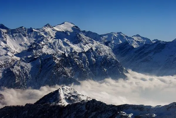
- Elevation
- 3,402 m
- above sea level
- Local time
- UTC+01:00
- Europe/Zurich · UTC+01:00
- Airports
- LUG Lugano Airport55 km
- MXP Milan Malpensa International Airport99 km
About Rheinwaldhorn
Rheinwaldhorn is a mountain. Location: Rheinwald, Region Viamala. Elevation: 3,402 m.
The Rheinwaldhorn (Italian: Adula) is the highest point in the Swiss canton of Ticino at 3,402 metres above sea level. It lies on the border between the cantons of Graubünden and Ticino, in the Adula massif, part of the St. Gotthard massif of the Adula Alps in southern Switzerland. The mountain is known by different names, in German as Rheinwaldhorn or Adulahorn, in Italian as l'Adula or Piz Valrhein, in Romansh as Piz Valragn.
Source: Wikipedia · CC BY-SA 4.0
At a glance
- Topographic prominence
- 1,337 m
Source: Wikidata
Photos of Rheinwaldhorn
-

Ertu kk · CC BY-SA 4.0 -

Johann Ludwig Bleuler, upload by Adrian Michael · Public domain -

Zacharie Grossen · CC BY-SA 3.0 -

Marco Lurati · CC BY-SA 3.0 -

Zacharie Grossen · Public domain


Climate of Rheinwaldhorn
This month · November
A wet month
Day -7° · Night -14° · Rain 115 mm
- Hottest month
- July (day 5°)
- Coldest month
- February (night -18°)
- Wettest month
- September (150 mm)
- Driest month
- February (72 mm)
Bars: average monthly low and high temperature. Below: precipitation. Monthly averages for 1970–2000 at about 18 km resolution, adjusted for elevation. Highlighted months are mild and relatively dry. Source: WorldClim 2.1 (CC BY 4.0).
Show values as a table
| Month | Jan | Feb | Mar | Apr | May | Jun | Jul | Aug | Sep | Oct | Nov | Dec |
|---|---|---|---|---|---|---|---|---|---|---|---|---|
| Average high (°C) | -10° | -10° | -9° | -7° | -2° | 1° | 5° | 5° | 1° | -3° | -7° | -9° |
| Average low (°C) | -17° | -18° | -16° | -13° | -9° | -6° | -3° | -3° | -6° | -10° | -14° | -16° |
| Precipitation (mm) | 92 | 72 | 99 | 133 | 145 | 149 | 147 | 149 | 150 | 143 | 115 | 91 |
How to get to Rheinwaldhorn
The nearest airport is Lugano Airport (LUG), 55 km to the south as the crow flies. For international flights: Milan Malpensa International Airport (MXP) (99 km). The nearest large city is Zurich, 104 km to the north.
Airports
- Lugano Airport (LUG) Agno 55 kmsouth
- Milan Malpensa International Airport (MXP) Ferno (VA) 99 kmsouth
- Il Caravaggio International Airport (BGY) Orio al Serio (BG) 105 kmsoutheast
Nearby large cities
- Zurich Population: 415.4K 104 kmnorth
- Winterthur Population: 111.8K 115 kmnorth
- Bern Population: 121.6K 132 kmnorthwest
- Basel Population: 177.6K 163 kmnorthwest
- Lausanne Population: 139.1K 185 kmwest
Straight-line distances; road distances are longer. Airport data: OurAirports.
Day trips from Rheinwaldhorn
Within 100 km: 158 historic and cultural sites, 7,145 natural sites, 902 lakes, rivers and coasts.
0–25 km664 places
- Lago Tremorgio Lake 25 kmW
- Laghetto Lake 21 kmSW
- Lago dei Campanitt Lake 21 kmW
- Lago di Luzzone Lake 10 kmNW
25–60 km3,200 places
- Lago Nero Lake 39 kmW
- Isole di Brissago Island 47 kmSW
- Sant' Apollinare Island 46 kmSW
- San Pancrazio Island 47 kmSW
60–100 km4,341 places
- Strandbad Neuhaus Beach 96 kmW
- Strandbad Manor Farm Beach 96 kmW
- Strandbad Leissigen Beach 99 kmW
- Strandbad Iseltwald Beach 85 kmW
Straight-line distances.
Nearest towns and villages
-
Alpe di Quarnajo Village, Serravalle2.1 km SW
-
Serravalle Municipality, Blenio District7 km S
-
Torre Village, Blenio6.7 km W
-
Soja Village, Blenio4.4 km W
-
Acquarossa Municipality, Blenio District9.4 km SW
-
Alpe di Scieru Village, Serravalle4.9 km S
Nearby attractions & nature
Everything nearby-
Vadrecc di Bresciana Natural site, Blenio0.6 km NW
-
Läntagletscher Natural site, Vals1.3 km N
-
Lògia Mountain, Serravalle1.4 km S
-
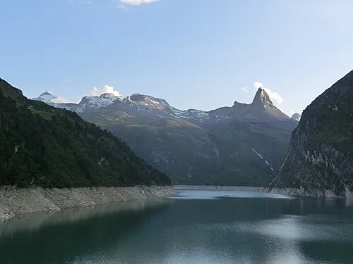 Güferhorn Mountain, Rheinwald2.7 km NE
-
Grauhorn Mountain, Blenio1.6 km NW
-
Costa della Lògia Mountain, Serravalle1.6 km S
-
Cima del Laghetto Mountain, Serravalle1.7 km W
-
Gemskanzel Mountain, Rheinwald1.7 km SE
Sources & licences
Data last updated: · 2 independent sources