Tête Verte
Located in Switzerland Coordinates: 45°52′13″ N 7°11′52″ E
- Elevation
- 2,856 m
- above sea level
- Local time
- UTC+01:00
- Europe/Zurich · UTC+01:00
About Tête Verte
Tête Verte is a mountain. Location: Switzerland. Elevation: 2,856 m.
In comparison
- No. 1829 of 7660 mountains in Switzerland by elevation
- 86 sights and natural places within 10 km Tête Rouge, Lac des Tronchets
Nearest towns and villages
-
Grand Saint Bernard Village, Bourg-Saint-Pierre2.1 km W
-
Saint-Rhémy-en-Bosses Municipality, Province of Aosta5.7 km S
-
Bourg-Saint-Pierre Municipality, Entremont District5.6 km N
-
Saint-Oyen Municipality, Province of Aosta5.3 km S
-
Etroubles Municipality, Province of Aosta6.1 km SE
-
Saint-Rhémy Village, Saint-Rhémy-en-Bosses4 km S
Nearby attractions & nature
Everything nearby-
Becs Noirs Mountain, Valais1.7 km N
-
Tête Rouge Mountain, Bourg-Saint-Pierre0.6 km N
-
Lac des Tronchets Lake, Bourg-Saint-Pierre0.9 km NW
-
Mont Mort Mountain, Bourg-Saint-Pierre1.7 km SW
-
Bastillons Mountain, Valais4.1 km NW
-
Pain de Sucre Mountain, Saint-Rhémy-en-Bosses4.5 km W
-
Pointe des Lacerandes Mountain, Bourg-Saint-Pierre2.4 km NW
-
Pointe de Crête Sèche Mountain, Bourg-Saint-Pierre2.5 km NE
More nature in Switzerland
-
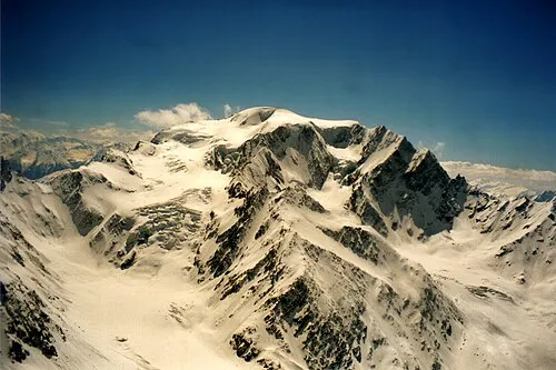 Mont Vélan Mountain, Switzerland4.8 km NE
-
Aiguille du Vélan Mountain, Bourg-Saint-Pierre4.7 km NE
-
Croix de Tsousse Mountain, Bourg-Saint-Pierre5.5 km N
-
Grande Chenalette Mountain, Bourg-Saint-Pierre2.6 km W
-
Pointe des Trois Lacs Mountain, Bourg-Saint-Pierre4 km NW
-
Glacier de Pro Natural site, Bourg-Saint-Pierre4 km NE
Sources & licences
Data last updated: