Ermatingen
Located in Kreuzlingen District, Thurgau Coordinates: 47°39′22″ N 9°05′30″ E
- Population
- 3,527
- 3.5K
- Elevation
- 517 m
- above sea level
- Local time
- UTC+01:00
- Europe/Zurich · UTC+01:00
- Places inside
- 14
- listed under Ermatingen
About Ermatingen
Ermatingen is a municipality. Location: Kreuzlingen District, Thurgau. Population: 3,527. Elevation: 517 m.
In comparison
- No. 3 of 14 places in Kreuzlingen District by population
- Nearest larger town: Tägerwilen, 3 km E
- 40 sights and natural places within 10 km Schloss Wolfsberg, Schloss Gottlieben
- Listed here: Village: 13, Historic site: 1
Places in Ermatingen
14 places-
Ermatingen Village2.5K
-
Agerstenbach Village
-
Birebomme Village
-
Höhnwilen Village
-
Lanterswilen Village
-
Neugut Village
-
Oberhöhnwilen Village
-
Schloss Wolfsberg Historic site
-
Triboltingen Village
-
Tüüffgwändli Village
-
Ulmberg Village
-
Westerfeld Village
-
Wolfsberg Village
-
Zum Polster Village
Nearby attractions & nature
Everything nearby-
Friedrichshöhe Mountain, Baden-Wurttemberg3.6 km NW
-
Schloss Gottlieben Historic site, Gottlieben3.4 km E
-
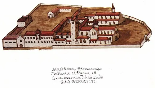 Petershausen Abbey Attraction, Konstanz6.7 km E
-
Reichenau Island Island, Baden-Wurttemberg4.5 km NW
-
Kloster Reichenau Attraction, Reichenau5.3 km NW
-
Connyland Natural site, Thurgau5.3 km SW
-
Emmishofenweiher Lake, Kreuzlingen5.2 km E
-
Schloss Altenklingen Historic site, Wigoltingen6.1 km S
Sources & licences
Data last updated: