Münchwilen District
Located in Thurgau, Switzerland Coordinates: 47°28′24″ N 8°59′17″ E
- Population
- 48,285
- 48.3K
- Elevation
- 518 m
- above sea level
- Local time
- UTC+01:00
- Europe/Zurich · UTC+01:00
- Places inside
- 13
- listed under Münchwilen District
About Münchwilen District
Münchwilen District is a district. Location: Thurgau, Switzerland. Population: 48,285.
In comparison
- 14 sights and natural places within 10 km Weiherhof, Kloster St. Katharina
- Listed here: Municipality: 13
Places in Münchwilen District
13 places-
Aadorf Municipality9K
-
Sirnach Municipality7.8K
-
Münchwilen (TG) Municipality5.7K
-
Wängi Municipality4.8K
-
Eschlikon Municipality4.5K
-
Bichelsee-Balterswil Municipality2.9K
-
Rickenbach (TG) Municipality2.8K
-
Fischingen Municipality2.8K
-
Wilen (TG) Municipality2.5K
-
Tobel-Tägerschen Municipality1.6K
-
Bettwiesen Municipality1.2K
-
Lommis Municipality1.2K
-
Braunau Municipality815
Nature and heritage in Münchwilen District
-
Kloster Fischingen Attraction, Fischingen
-
Kloster Tänikon Attraction, Aadorf
-
Bichselsee Lake, Bichelsee-Balterswil
-
Weiherhof Lake, Sirnach
Nearby attractions & nature
Everything nearby-
Kloster St. Katharina Attraction, Wil (SG)4.8 km E
-
Schloss Sonnenberg Historic site, Stettfurt6.4 km N
-
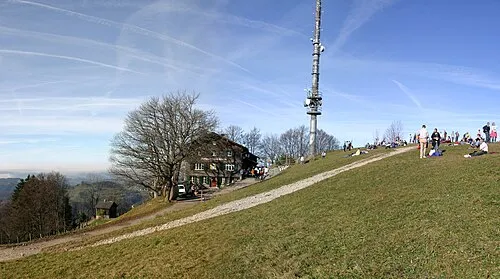 Hörnli Mountain, Fischenthal12 km S
-
Hundsrugge Mountain, Thurgau10 km NW
-
Hasenlooweiher Lake, Wil (SG)7.2 km E
-
Honegg Mountain, Thurgau11 km N
Sources & licences
Data last updated: