- Elevation
- 3,553 m
- above sea level
- Local time
- UTC+01:00
- Europe/Zurich · UTC+01:00
- Airports
- LUG Lugano Airport68 km
- MXP Milan Malpensa International Airport84 km
About Monte Leone
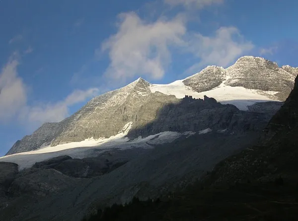
Monte Leone is a mountain. Location: Zwischbergen, Brig District. Elevation: 3,553 m.
Monte Leone is the highest mountain of the Lepontine Alps and is located on the border between Switzerland and Italy. The mountain stands on the extreme west of the Lepontine Alps, a few kilometres east of Simplon Pass.
Source: Wikipedia · CC BY-SA 4.0
At a glance
- Topographic prominence
- 1,144 m
Source: Wikidata
Climate of Monte Leone
This month · November
A cold month
Day -8° · Night -14° · Rain 81 mm
- Hottest month
- August (day 5°)
- Coldest month
- February (night -18°)
- Wettest month
- May (91 mm)
- Driest month
- February (63 mm)
Bars: average monthly low and high temperature. Below: precipitation. Monthly averages for 1970–2000 at about 18 km resolution, adjusted for elevation. Highlighted months are mild and relatively dry. Source: WorldClim 2.1 (CC BY 4.0).
Show values as a table
| Month | Jan | Feb | Mar | Apr | May | Jun | Jul | Aug | Sep | Oct | Nov | Dec |
|---|---|---|---|---|---|---|---|---|---|---|---|---|
| Average high (°C) | -11° | -11° | -10° | -8° | -3° | 1° | 5° | 5° | 1° | -3° | -8° | -10° |
| Average low (°C) | -17° | -18° | -17° | -14° | -10° | -7° | -4° | -3° | -6° | -10° | -14° | -16° |
| Precipitation (mm) | 66 | 63 | 76 | 84 | 91 | 85 | 77 | 85 | 76 | 91 | 81 | 68 |
How to get to Monte Leone
The nearest airport is Lugano Airport (LUG), 68 km to the southeast as the crow flies. For international flights: Milan Malpensa International Airport (MXP) (84 km). The nearest large city is Bern, 93 km to the northwest.
Airports
- Lugano Airport (LUG) Agno 68 kmsoutheast
- Milan Malpensa International Airport (MXP) Ferno (VA) 84 kmsoutheast
- Bern Airport (BRN) Bern 87 kmnorthwest
Nearby large cities
- Bern Population: 121.6K 93 kmnorthwest
- Lausanne Population: 139.1K 117 kmwest
- Zurich Population: 415.4K 129 kmnorth
- Winterthur Population: 111.8K 147 kmnorth
- Basel Population: 177.6K 151 kmnorth
Straight-line distances; road distances are longer. Airport data: OurAirports.
Nearest towns and villages
Nearby attractions & nature
Everything nearby-
Stichelgrat Mountain, Valais1 km S
-
Gli Amonciei Mountain, Valais1.3 km NE
-
Alpjergletscher Natural site, Zwischbergen1.3 km SW
-
Pizzo d'Avino Mountain, Zwischbergen1.7 km SE
-
Rossetto Mountain, Valais2 km N
-
Chaltwassergletscher Natural site, Ried-Brig1.9 km W
-
Vierte See Lake, Zwischbergen1.9 km S
-
Pizzo Fne Mountain, Valais2.3 km SE
Sources & licences
Data last updated: · 2 independent sources