Goms
Located in Goms District, Valais Coordinates: 46°28′14″ N 8°14′51″ E
- Population
- 1,184
- 1.2K
- Elevation
- 1,318 m
- above sea level
- Local time
- UTC+01:00
- Europe/Zurich · UTC+01:00
- Places inside
- 89
- listed under Goms
About Goms
Goms is a municipality. Location: Goms District, Valais. Population: 1,184. Elevation: 1,318 m.
In comparison
- Most populous of 8 places in Goms District
- Nearest larger town: Naters, 22 km W
- 145 sights and natural places within 10 km Raifte, Chastebiel
- Listed here: Mountain: 50, Village: 17, Lake: 15, Natural site: 7
Places in Goms
89 places-
Blitzingen Village85
-
Niederwald Village62
-
Geschinen Village57
-
Äbmete Village
-
Ammere Village
-
Arnergale Mountain
-
Bächigletscher Natural site
-
Bidmerseewji Lake
-
Biel Village
-
Blaggibärg Mountain
-
Blaws Seewji Lake
-
Blinnengletscher Natural site
-
Bochtehorn Mountain
-
Bockbiel Mountain
-
Bodme Village
-
Brudelhorn Mountain
-
Brusee Lake
-
Chastebiel Mountain
-
Chastebiel Village
-
Chietalnolle Mountain
-
Chietalnollen Mountain
-
Chietalstock Mountain
-
Chly Chastelhorn Mountain
-
Firehorn Mountain
-
Flesch Lake
-
Gadme Village
-
Gälmjinihörner Mountain
-
Gemschbärg Mountain
-
Gluringen Village
-
Grathorn Mountain
-
Grauhorn Mountain
-
Grittlesee Lake
-
Gross Chastelhorn Mountain
-
Grundle Lake
-
Hangendgletscher Natural site
-
Heji Zwächte Mountain
-
Herchummegrat Mountain
-
Hinnerbru Mountain
-
Hinteres Galmihorn Mountain
-
Holöüwibiel Mountain
-
Honegga Mountain
-
Honeggerhorn Mountain
-
Klein Blinnenhorn Mountain
-
Lengsee Lake
-
Lengsee Lake
-
Löffelhorn Mountain
-
Löuwenestock Mountain
-
Mannlibode Mountain
-
Merezebachgletscher Natural site
-
Merezebachgletscher Natural site
-
Merezebachschije Mountain
-
Minstigergletscher Natural site
-
Mittelsee Lake
-
Mittle Lake
-
Mossmattestock Mountain
-
Münster Village
-
Murmetebärge Mountain
-
Obere Stock Mountain
-
Raifte Mountain
-
Reckingen Village
Nearby attractions & nature
Everything nearby-
Goms Natural site, Valais4.8 km SW
-
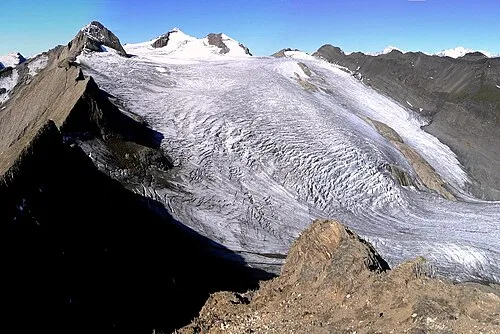 Blinnenhorn Mountain, Switzerland6.8 km SE
-
Chummehorn Mountain, Ernen5.2 km S
-
Straaleloch Mountain, Obergoms5.3 km NE
-
Biel Mountain, Obergoms6 km NE
-
Rappehorn Mountain, Ernen6.4 km S
-
Geschinerstock Mountain, Obergoms6.6 km N
-
Corno Rosso Mountain, Formazza7.8 km SE
Sources & licences
Data last updated: