- Elevation
- 3,248 m
- above sea level
- Local time
- UTC+01:00
- Europe/Zurich · UTC+01:00
- Airports
- BRN Bern Airport63 km
- GVA Geneva International Airport97 km
About Wildhorn
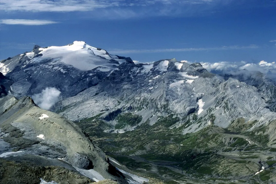
Wildhorn is a mountain. Location: Ayent, Hérens District. Elevation: 3,248 m.
The Wildhorn is a mountain of the Alps, straddling the border between the Swiss cantons of Bern and Valais. At 3,250 metres (10,663 ft) above sea level, it is the highest summit of the Bernese Alps west of the Gemmi Pass. It forms a large glaciated massif, about 10 km wide, extending between the Sanetsch Pass and the Rawil Pass. Along with the Muverans, the Diablerets and the Wildstrubel, the Wildhorn is one of the four distinct mountain massifs of the Bernese Alps that lie west of the Gemmi Pass.
Source: Wikipedia · CC BY-SA 4.0
At a glance
- Topographic prominence
- 981 m
Source: Wikidata
Photos of Wildhorn
-

Falk2 · CC BY-SA 4.0 -

KlausFoehl · CC BY-SA 3.0 -

Paradise Chronicle · CC BY-SA 4.0 -

Björn S... · CC BY-SA 2.0 -

Björn S... · CC BY-SA 2.0


Climate of Wildhorn
This month · November
A wet month
Day -6° · Night -12° · Rain 123 mm
- Hottest month
- August (day 7°)
- Coldest month
- February (night -16°)
- Wettest month
- December (128 mm)
- Driest month
- September (85 mm)
Bars: average monthly low and high temperature. Below: precipitation. Monthly averages for 1970–2000 at about 18 km resolution, adjusted for elevation. Highlighted months are mild and relatively dry. Source: WorldClim 2.1 (CC BY 4.0).
Show values as a table
| Month | Jan | Feb | Mar | Apr | May | Jun | Jul | Aug | Sep | Oct | Nov | Dec |
|---|---|---|---|---|---|---|---|---|---|---|---|---|
| Average high (°C) | -10° | -10° | -8° | -6° | -1° | 3° | 6° | 7° | 3° | -1° | -6° | -9° |
| Average low (°C) | -16° | -16° | -15° | -13° | -8° | -5° | -2° | -2° | -4° | -8° | -12° | -15° |
| Precipitation (mm) | 117 | 120 | 103 | 102 | 107 | 107 | 95 | 98 | 85 | 108 | 123 | 128 |
How to get to Wildhorn
The nearest airport is Bern Airport (BRN), 63 km to the north as the crow flies. For international flights: Geneva International Airport (GVA) (97 km). The nearest large city is Lausanne, 59 km to the west.
Airports
- Bern Airport (BRN) Bern 63 kmnorth
- Geneva International Airport (GVA) Geneva 97 kmwest
- Annecy Meythet airport (NCY) Annecy 108 kmsouthwest
Nearby large cities
- Lausanne Population: 139.1K 59 kmwest
- Bern Population: 121.6K 66 kmnorth
- Geneva Population: 201.7K 95 kmwest
- Basel Population: 177.6K 135 kmnorth
- Besançon Population: 128.4K 143 kmnorthwest
Straight-line distances; road distances are longer. Airport data: OurAirports.
Day trips from Wildhorn
Within 100 km: 142 historic and cultural sites, 5,216 natural sites, 639 lakes, rivers and coasts.
0–25 km594 places
- Lac de Derborence Lake 14 kmSW
- Daubensee Lake 21 kmE
- Arnensee Lake 12 kmW
- Lauenensee Lake 5 kmNW
25–60 km2,656 places
- Strandbad Neuhaus Beach 50 kmNE
- Strandbad Manor Farm Beach 50 kmNE
- Strandbad Leissigen Beach 46 kmNE
- Ile de Salagnon Island 38 kmW
60–100 km2,747 places
- Kleiner Bremgartenwald Mountain 69 kmN
- Strandbad Iseltwald Beach 62 kmNE
- Strandbad Brienz Beach 69 kmNE
- Lago Nero Lake 91 kmE
Straight-line distances.
Nearest towns and villages
Nearby attractions & nature
Everything nearby-
Mont Pucel Mountain, Savièse0.8 km S
-
Glacier du Brochet Natural site, Savièse0.7 km S
-
Glacier du Wildhorn Natural site, Ayent0.8 km E
-
Glacier du Brochet Natural site, Savièse1.1 km SW
-
Tungelgletscher Natural site, Lauenen1.4 km NE
-
Pfaffehorn Mountain, Lauenen1.8 km NE
-
Gältegletscher Natural site, Lauenen1.7 km W
-
Hahneschritthore Mountain, Lauenen1.9 km N
Sources & licences
Data last updated: · 2 independent sources