- Elevation
- 2,059 m
- above sea level
- Local time
- UTC+01:00
- Europe/Zurich · UTC+01:00
- Airports
- BRN Bern Airport72 km
- LUG Lugano Airport79 km
About Schweibuflüe
Schweibuflüe is a mountain. Location: Riederalp, Raron District. Elevation: 2,059 m. The nearest airport is Bern Airport (72 km). Nearby sights include Blausee and Moosfluo.
Photos of Schweibuflüe
-
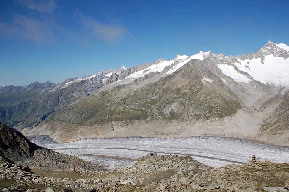
Geisshorn Fritz Geller-Grimm · CC BY-SA 3.0

Climate of Schweibuflüe
This month · November
A cold month
Day 1° · Night -5° · Rain 85 mm
- Hottest month
- August (day 13°)
- Coldest month
- February (night -9°)
- Wettest month
- August (93 mm)
- Driest month
- February (69 mm)
Bars: average monthly low and high temperature. Below: precipitation. Monthly averages for 1970–2000 at about 18 km resolution, adjusted for elevation. Highlighted months are mild and relatively dry. Source: WorldClim 2.1 (CC BY 4.0).
Show values as a table
| Month | Jan | Feb | Mar | Apr | May | Jun | Jul | Aug | Sep | Oct | Nov | Dec |
|---|---|---|---|---|---|---|---|---|---|---|---|---|
| Average high (°C) | -2° | -2° | 0° | 2° | 6° | 10° | 13° | 13° | 10° | 6° | 1° | -1° |
| Average low (°C) | -8° | -9° | -7° | -5° | -1° | 3° | 5° | 6° | 3° | 0° | -5° | -7° |
| Precipitation (mm) | 72 | 69 | 80 | 85 | 91 | 92 | 88 | 93 | 81 | 90 | 85 | 74 |
How to get to Schweibuflüe
The nearest airport is Bern Airport (BRN), 72 km to the northwest as the crow flies. For international flights: Milan Malpensa International Airport (MXP) (99 km). The nearest large city is Bern, 78 km to the northwest.
Airports
- Bern Airport (BRN) Bern 72 kmnorthwest
- Lugano Airport (LUG) Agno 79 kmsoutheast
- Milan Malpensa International Airport (MXP) Ferno (VA) 99 kmsoutheast
Nearby large cities
- Bern Population: 121.6K 78 kmnorthwest
- Lausanne Population: 139.1K 110 kmwest
- Zurich Population: 415.4K 116 kmnorth
- Winterthur Population: 111.8K 135 kmnorth
- Basel Population: 177.6K 135 kmnorth
Straight-line distances; road distances are longer. Airport data: OurAirports.
Day trips from Schweibuflüe
Within 100 km: 160 historic and cultural sites, 6,698 natural sites, 811 lakes, rivers and coasts.
0–25 km828 places
- Innersts Seewji Lake 25 kmSW
- Stausee Gibidum Lake 4 kmW
- Oberhoresee Lake 19 kmNW
- Schönboden See Lake 4 kmNE
25–60 km3,184 places
- Strandbad Neuhaus Beach 37 kmNW
- Strandbad Manor Farm Beach 38 kmNW
- Strandbad Leissigen Beach 37 kmNW
- Strandbad Iseltwald Beach 37 kmN
60–100 km3,657 places
- Kleiner Bremgartenwald Mountain 80 kmNW
- Ile de Salagnon Island 90 kmW
- Insel Schwanau Island 83 kmNE
- Sankt-Niklausen-Insle Island 76 kmN
Straight-line distances.
Nearest towns and villages
-
Goppisberg Village, Riederalp1.5 km S
-
Betten Village, Bettmeralp1.8 km SE
-
Mörel Village, Riederalp3.1 km S
-
 Bettmeralp Village, Bettmeralp1.3 km NE
-
Riederalp Village, Riederalp1.9 km SW
-
Greich Village, Riederalp1.9 km S
Nearby attractions & nature
Everything nearby-
Blausee Lake, Riederalp0.7 km NW
-
Moosfluo Mountain, Riederalp1.2 km N
-
Hoflüe Mountain, Riederalp1.4 km W
-
Hohfluh Mountain, Riederalp1.6 km W
-
Grosse Putz Lake, Riederalp1.6 km W
-
Bettmersee Lake, Bettmeralp1.4 km NE
-
Baschweri Mountain, Bettmeralp2.2 km E
-
Aletschwald Natural site, Switzerland2.3 km SW
Sources & licences
Data last updated: