Pointe de la Plaine Mort
Located in Crans-Montana, Sierre District Coordinates: 46°22′14″ N 7°29′13″ E
- Elevation
- 2,927 m
- above sea level
- Local time
- UTC+01:00
- Europe/Zurich · UTC+01:00
- Airports
- BRN Bern Airport60 km
- GVA Geneva International Airport107 km
About Pointe de la Plaine Mort
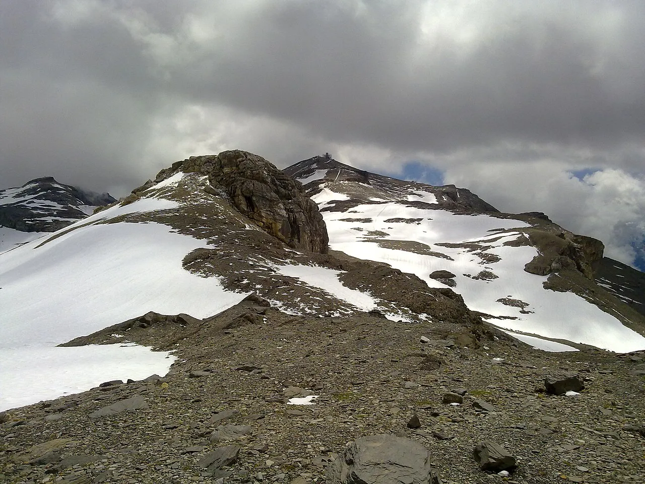
Pointe de la Plaine Mort is a mountain. Location: Crans-Montana, Sierre District. Elevation: 2,927 m.
The Pointe de la Plaine Morte (2,927 metres (9,603 ft)) is a mountain of the Bernese Alps, located on the border between the Swiss cantons of Bern and Valais. It overlooks the large and flat glacier named Plaine Morte Glacier, from the south-west side. The Pointe de la Plaine Morte is part of the Crans-Montana ski area and can be easily accessed by a cable car via Les Violettes. The upper terminus is located east of the summit at a height of 2,882 metres (9,455 ft).
Source: Wikipedia · CC BY-SA 4.0
Photos of Pointe de la Plaine Mort
-

Picea Abies · CC BY-SA 3.0 -

rokker · CC BY 3.0 -

Björn S · CC BY-SA 2.0 -

Björn S · CC BY-SA 2.0 -

Picea Abies · CC BY-SA 3.0


Climate of Pointe de la Plaine Mort
This month · November
A wet month
Day -4° · Night -10° · Rain 123 mm
- Hottest month
- August (day 9°)
- Coldest month
- February (night -14°)
- Wettest month
- December (128 mm)
- Driest month
- September (85 mm)
Bars: average monthly low and high temperature. Below: precipitation. Monthly averages for 1970–2000 at about 18 km resolution, adjusted for elevation. Highlighted months are mild and relatively dry. Source: WorldClim 2.1 (CC BY 4.0).
Show values as a table
| Month | Jan | Feb | Mar | Apr | May | Jun | Jul | Aug | Sep | Oct | Nov | Dec |
|---|---|---|---|---|---|---|---|---|---|---|---|---|
| Average high (°C) | -8° | -8° | -6° | -4° | 2° | 5° | 8° | 9° | 5° | 1° | -4° | -7° |
| Average low (°C) | -14° | -14° | -13° | -10° | -6° | -3° | 0° | 1° | -2° | -6° | -10° | -13° |
| Precipitation (mm) | 117 | 120 | 103 | 102 | 107 | 107 | 95 | 98 | 85 | 108 | 123 | 128 |
How to get to Pointe de la Plaine Mort
The nearest airport is Bern Airport (BRN), 60 km to the north as the crow flies. For international flights: Geneva International Airport (GVA) (107 km). The nearest large city is Bern, 64 km to the north.
Airports
- Bern Airport (BRN) Bern 60 kmnorth
- Geneva International Airport (GVA) Geneva 107 kmwest
- Lugano Airport (LUG) Agno 117 kmeast
Nearby large cities
- Bern Population: 121.6K 64 kmnorth
- Lausanne Population: 139.1K 68 kmwest
- Geneva Population: 201.7K 105 kmwest
- Basel Population: 177.6K 132 kmnorth
- Zurich Population: 415.4K 137 kmnortheast
Straight-line distances; road distances are longer. Airport data: OurAirports.
Day trips from Pointe de la Plaine Mort
Within 100 km: 138 historic and cultural sites, 5,643 natural sites, 710 lakes, rivers and coasts.
0–25 km656 places
- Oeschinen Lake Lake 23 kmNE
- Lac de Derborence Lake 23 kmSW
- Daubensee Lake 11 kmNE
- Blausee Lake 23 kmNE
25–60 km2,862 places
- Strandbad Neuhaus Beach 43 kmNE
- Strandbad Manor Farm Beach 43 kmNE
- Strandbad Leissigen Beach 38 kmNE
- Strandbad Iseltwald Beach 53 kmNE
60–100 km2,973 places
- Kleiner Bremgartenwald Mountain 67 kmN
- Strandbad Brienz Beach 60 kmNE
- Lago Nero Lake 81 kmE
- Sankt Petersinsel Island 82 kmN
Straight-line distances.
Nearest towns and villages
-
Crans-Montana Town, Crans-Montana6.4 km S
-
Montana Village, Crans-Montana6.4 km S
-
Randogne Village, Crans-Montana6.9 km S
-
Lenk Municipality, Obersimmental-Saanen District6.5 km N
-
Ayent Municipality, Hérens District7.6 km SW
-
Noble-Contrée Municipality, Sierre District7.9 km SE
Nearby attractions & nature
Everything nearby-
Pointe de Vatseret Mountain, Icogne0.9 km NW
-
Sex Mort Mountain, Crans-Montana1 km E
-
Weisshorn Mountain, Icogne1.8 km NW
-
Weisshornsee Lake, Icogne0.9 km W
-
Tubang Mountain, Crans-Montana1.5 km SE
-
Lac de Huiton Lake, Valais0.9 km W
-
Mont Bonvin Mountain, Crans-Montana1.7 km SE
-
Rohrbachstein Mountain, Ayent2 km W
Sources & licences
Data last updated: · 2 independent sources