Sleen
Located in Coevorden, Drenthe Coordinates: 52°46′18″ N 6°48′10″ E
- Population
- 2,200
- 2.2K
- Elevation
- 18 m
- above sea level
- Local time
- UTC+01:00
- Europe/Amsterdam · UTC+01:00
About Sleen
Sleen is a village. Location: Coevorden, Drenthe. Population: 2,200. Elevation: 18 m.
Sleen is a village in Drenthe, Netherlands of about 2,500 people. Sleen has been inhabited for centuries. Much ancient history can be found in the area, particularly in the forests (which are planted, though). At birth and during the Republiek der Zeven Verenigde Nederlanden (Republic of the Seven United Netherlands (1581–1795)). Sleen became the capital of one of the six “dingspels” (administrative areas) of Drenthe.
Read more on Wikipedia Text: Wikipedia contributors · CC BY-SA 4.0 · shortened
In comparison
- No. 3 of 29 places in Coevorden by population
- Nearest larger town: Bargeres, 5 km E
Nearby attractions & nature
Everything nearby-
Breiberg Mountain, Coevorden14 km SW
-
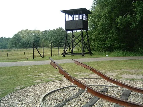 Police Custody Camp Westerbork Historic site, Gemeente Midden-Drenthe16 km NW
-
Auf dem Bült Mountain, Twist24 km SE
-
Radewijke River, Thuringia24 km S
-
Twister Aa River, Twist22 km SE
Sources & licences
Data last updated: · 2 independent sources