Klatering
Located in Gemeente Midden-Drenthe, Drenthe Coordinates: 52°52′21″ N 6°32′35″ E
- Elevation
- 15 m
- above sea level
- Local time
- UTC+01:00
- Europe/Amsterdam · UTC+01:00
About Klatering
Klatering is a village. Location: Gemeente Midden-Drenthe, Drenthe. Elevation: 15 m.
In comparison
Airports nearest to Klatering
- Groningen Airport Eelde (GRQ) Groningen 28 km
- Münster Osnabrück Airport (FMO) Greven 113 km
- Amsterdam Airport Schiphol (AMS) Amsterdam 136 km
Straight-line distance; airports with scheduled flights only. Source: OurAirports (public domain).
Nearby attractions & nature
Everything nearby-
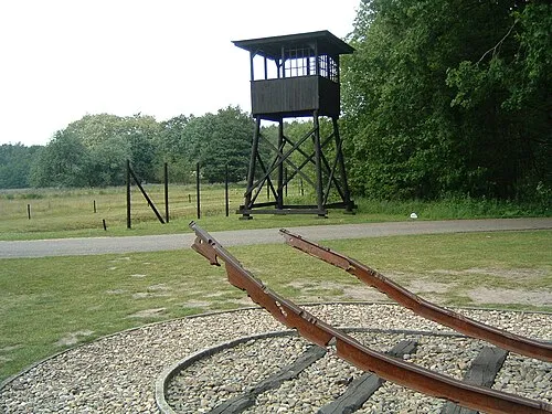 Police Custody Camp Westerbork Historic site, Gemeente Midden-Drenthe4.9 km SE
-
Bendersche Berg Mountain, Gemeente Westerveld13 km SW
-
Hunnenkloosterberg Mountain, Gemeente De Wolden19 km SW
-
Boschberg Mountain, Ooststellingwerf Municipality16 km NW
-
Havelterberg Mountain, Gemeente Westerveld23 km W
-
Breiberg Mountain, Coevorden23 km S
Sources & licences
Data last updated: · 2 independent sources