Denekamp
Located in Gemeente Dinkelland, Overijssel Coordinates: 52°22′39″ N 7°00′25″ E
- Population
- 9,125
- 9.1K
- Elevation
- 25 m
- above sea level
- Local time
- UTC+01:00
- Europe/Amsterdam · UTC+01:00
About Denekamp
Denekamp is a town. Location: Gemeente Dinkelland, Overijssel. Population: 9,125. Elevation: 25 m.
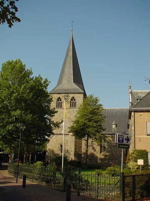
Denekamp (Dutch pronunciation: [ˈdeːnəkɑmp] ) is a town in the Dutch province of Overijssel. It is a part of the region of Twente and the municipality of Dinkelland, and lies about 9 km northeast of Oldenzaal. The town was first noted as early as the 10th century when it was referred to as Daginghem, and means "settlement of the people of Dago or Dano". The village started around the church which was built in 1275. It remained isolated and small until 1829 when the road from Deventer to Hamburg was built.
Read more on Wikipedia Text: Wikipedia contributors · CC BY-SA 4.0 · shortened
In comparison
- Most populous of 7 places in Gemeente Dinkelland
- Nearest larger town: Nordhorn, 6 km NE
- 5 sights and natural places within 10 km Paasberg, Strenge
Nearby attractions & nature
Everything nearby-
Paasberg Mountain, Losser Municipality5.9 km SW
-
Kersberg Mountain, Gemeente Dinkelland9.6 km NW
-
Strenge River, Lower Saxony6 km SE
-
Isterberg Mountain, Isterberg10 km E
-
Naturschutzgebiet Syenvenn Natural site, Nordhorn7.3 km E
-
Vechtesee Lake, Nordhorn7.8 km NE
-
Braamberg Mountain, Tubbergen Municipality13 km NW
-
Tutenberg Mountain, Tubbergen Municipality13 km NW
Sources & licences
Data last updated: · 2 independent sources