- Population
- 403
- 403
- Elevation
- 45 m
- above sea level
- Local time
- UTC+03:00
- Europe/Istanbul · UTC+03:00
- Airports
- COV Çukurova International Airport77 km
- KCM Kahramanmaraş Airport106 km
About Camızağılı
Camızağılı is a village. Location: Ceyhan, Adana Province. Population: 403. Elevation: 45 m.
Camuzağılı is a neighbourhood in the municipality and district of Ceyhan, Adana Province, Turkey. Its population is 403 (2022).
Source: Wikipedia · CC BY-SA 4.0
Population of Camızağılı over time
| 2013 | 498 | |
|---|---|---|
| 2014 | 491 | |
| 2015 | 479 | |
| 2016 | 448 | |
| 2017 | 448 | |
| 2018 | 467 | |
| 2019 | 442 | |
| 2020 | 416 | |
| 2021 | 393 | |
| 2022 | 403 | |
| 2023 | 485 |
Censuses and official estimates; source: Wikidata.
Climate of Camızağılı
Best months for sightseeingBest months for sightseeing: April, November.
This month · November
A good month to visit
Day 23° · Night 10° · Rain 70 mm
- Hottest month
- July (day 36°)
- Coldest month
- January (night 5°)
- Wettest month
- December (123 mm)
- Driest month
- August (14 mm)
Bars: average monthly low and high temperature. Below: precipitation. Monthly averages for 1970–2000 at about 18 km resolution, adjusted for elevation. Highlighted months are mild and relatively dry. Source: WorldClim 2.1 (CC BY 4.0).
Show values as a table
| Month | Jan | Feb | Mar | Apr | May | Jun | Jul | Aug | Sep | Oct | Nov | Dec |
|---|---|---|---|---|---|---|---|---|---|---|---|---|
| Average high (°C) | 15° | 16° | 19° | 24° | 28° | 33° | 36° | 36° | 34° | 29° | 23° | 17° |
| Average low (°C) | 5° | 6° | 8° | 12° | 15° | 19° | 23° | 23° | 20° | 15° | 10° | 7° |
| Precipitation (mm) | 108 | 87 | 87 | 77 | 66 | 37 | 15 | 14 | 22 | 57 | 70 | 123 |
How to get to Camızağılı
The nearest airport is Çukurova International Airport (COV), 77 km to the southwest as the crow flies. The nearest large city is Osmaniye, 44 km to the southeast.
Airports
- Çukurova International Airport (COV) Tarsus 77 kmsouthwest
- Kahramanmaraş Airport (KCM) Kahramanmaraş 106 kmeast
- Hatay Airport (HTY) Antakya 108 kmsoutheast
Nearby large cities
- Osmaniye Population: 202.8K 44 kmsoutheast
- Adana Population: 1.8M 52 kmsouthwest
- İskenderun Population: 251.7K 81 kmsoutheast
- Tarsus Population: 350.7K 90 kmsouthwest
- Arsuz Population: 109.6K 94 kmsouth
Straight-line distances; road distances are longer. Airport data: OurAirports.
Nearby attractions & nature
Everything nearby-
Andvorza Harabesi Historic site, Kozan6.9 km E
-
Anavarza Tepesi Mountain, Ceyhan9.2 km E
-
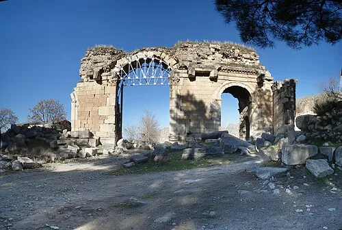 Anazarbus Historic site, Kozan8.8 km E
-
Anavarza Kalesi Historic site, Kozan8.6 km E
-
Koca Dere River, Adana Province7.9 km SE
-
Tabak Deresi River, Adana Province8.8 km NE
Sources & licences
Data last updated: · 2 independent sources