Ulus
Located in Altındağ, Ankara Province Coordinates: 39°56′22″ N 32°51′12″ E
- Elevation
- 866 m
- above sea level
- Local time
- UTC+03:00
- Europe/Istanbul · UTC+03:00
About Ulus
Ulus is a neighbourhood. Location: Altındağ, Ankara Province.
Ulus is a quarter in Ankara, Turkey and is located at the center of the capital city. It was once the heart of old Ankara. The name means "tribe, nation" in Turkish. It is now a predominantly a commercial and tourist area made up of banks, malls, shops, hotels, businesses, restaurants, and many historical sites. The first Turkish Grand National Assembly convened here in 1923 in the parliament building at Ulus Square (Turkish: Ulus Meydanı), which still stands in original.
Read more on Wikipedia Text: Wikipedia contributors · CC BY-SA 4.0 · shortened
In comparison
- Nearest larger town: Maltepe, 2 km S
- 79 sights and natural places within 10 km Gençlik Parkı, Ondokuz Mayıs Stadyumu
Nearby attractions & nature
Everything nearby-
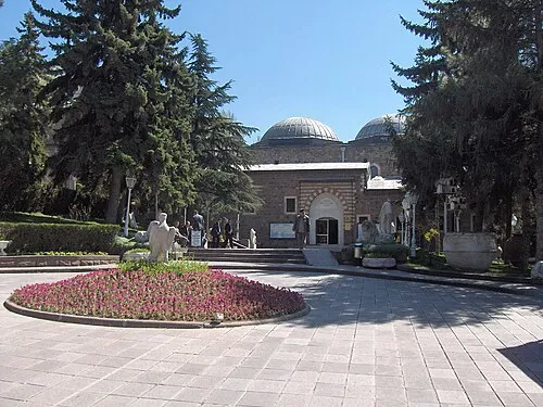 Museum of Anatolian Civilizations Museum, Altındağ0.8 km E
-
Gençlik Parkı Natural site, Altındağ0.4 km SW
-
Ondokuz Mayıs Stadyumu Landmark, Altındağ0.7 km W
-
Hacı Bayram Camii Attraction, Altındağ0.7 km NE
-
Ankara Kalesi Historic site, Altındağ0.7 km E
-
Aslanhane Camii Attraction, Altındağ1 km E
Sources & licences
Data last updated: · 2 independent sources