Bahçelievler
Located in Çankaya, Ankara Province Coordinates: 39°55′29″ N 32°49′30″ E
- Population
- 10,638
- 10.6K
- Elevation
- 900 m
- above sea level
- Local time
- UTC+03:00
- Europe/Istanbul · UTC+03:00
About Bahçelievler
Bahçelievler is a neighbourhood. Location: Çankaya, Ankara Province. Population: 10,638.
Bahçelievler is a neighbourhood in the municipality and district of Çankaya, Ankara Province, Turkey. Its population is 10,638 (2022). The name means 'houses with gardens' in Turkish. The neighborhood was known in the 1970s as a battleground for the right and left wing political factions. In particular, it is the place of the Bahçelievler massacre of 8 October 1978, when 7 students, members of the Workers' Party of Turkey, were killed by neo-fascists, see "Multi-party period of the Republic of Turkey".
Read more on Wikipedia Text: Wikipedia contributors · CC BY-SA 4.0 · shortened
In comparison
- No. 3 of 14 places in Çankaya by population
- Nearest larger town: Ankara, 3 km E
- 72 sights and natural places within 10 km Anıtpark, Türkiye Cumhuriyeti Devlet Demiryolları Açık Hava Müzesi
Nearby attractions & nature
Everything nearby-
Anıtpark Natural site, Çankaya0.9 km SE
-
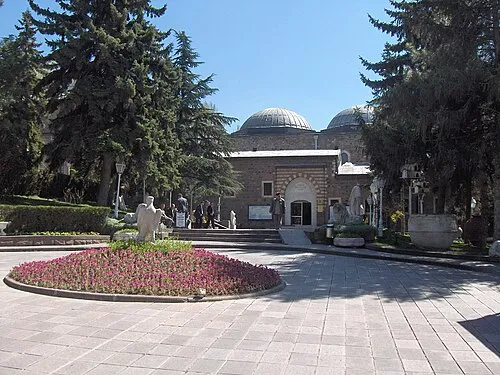 Museum of Anatolian Civilizations Museum, Altındağ3.5 km NE
-
Türkiye Cumhuriyeti Devlet Demiryolları Açık Hava Müzesi Museum, Çankaya2.1 km NE
-
Güven Parkı Natural site, Çankaya2.5 km E
-
Zafer Anıtı Landmark, Çankaya2.5 km E
-
Köprübaşı Camii Attraction, Çankaya2.6 km S
Sources & licences
Data last updated: · 2 independent sources