Hacıgelen
Located in Lâpseki İlçesi, Çanakkale Province Coordinates: 40°10′50″ N 26°43′38″ E
- Elevation
- 351 m
- above sea level
- Local time
- UTC+03:00
- Europe/Istanbul · UTC+03:00
About Hacıgelen
Hacıgelen is a village. Location: Lâpseki İlçesi, Çanakkale Province. Elevation: 351 m.
In comparison
- Nearest larger town: Hacılar, 4 km E
- 4 sights and natural places within 10 km Kocakır Tepe, Ağı Dağı
Airports nearest to Hacıgelen
- Çanakkale Airport (CKZ) Çanakkale 26 km
- Balıkesir Koca Seyit Airport (EDO) Edremit 74 km
- Alexandroupoli Democritus Airport (AXD) Alexandroupolis 99 km
Straight-line distance; airports with scheduled flights only. Source: OurAirports (public domain).
Nearby attractions & nature
Everything nearby-
Ağı Dağı Mountain, Canakkale6.5 km SW
-
Kocakır Tepe Mountain, Lâpseki İlçesi6.2 km SW
-
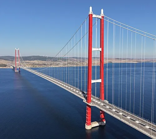 1915 Çanakkale Bridge Landmark, Gelibolu İlçesi19 km NW
-
Koru Deresi River, Çanakkale Province8.1 km N
-
Ulu Dere River, Çanakkale Province8.6 km NW
-
Dede Dağı Mountain, Canakkale11 km SW
Sources & licences
Data last updated: