Kayabaşı
Located in Başakşehir, Istanbul Coordinates: 41°06′41″ N 28°44′33″ E
- Population
- 112,367
- 112.4K
- Elevation
- 130 m
- above sea level
- Local time
- UTC+03:00
- Europe/Istanbul · UTC+03:00
About Kayabaşı
Kayabaşı is a neighbourhood. Location: Başakşehir, Istanbul. Population: 112,367.
Kayabaşı is a neighbourhood in the municipality and district of Başakşehir, Istanbul Province, Turkey. Its population is 111,395 (2022). It was formerly known as Ayayorgi (from Greek: Άγιος Γεώργιος, "St. George") and Azatlı until the Greco-Turkish population exchange of 1923. Kayabaşı was a district of Bakırköy until 1987 then it was a quarter of Küçükçekmece where was a part of the Çatalca kaza until 1908. By the last change of administrative division of İstanbul in 2009 it is a quarter of Başakşehir.
Read more on Wikipedia Text: Wikipedia contributors · CC BY-SA 4.0 · shortened
At a glance
- Area
- 13.8 km²
Source: Wikidata
In comparison
- Nearest larger town: Başakşehir, 4 km E
- 13 sights and natural places within 10 km Salkımsöğüt Tepesi, Eskibarıthane Gölü
Nearby attractions & nature
Everything nearby-
Salkımsöğüt Tepesi Mountain, Başakşehir2.4 km SE
-
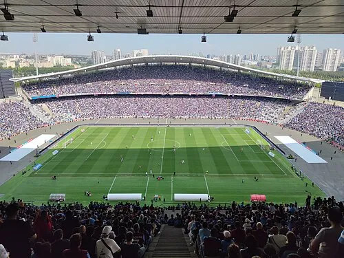 Atatürk Olympic Stadium Landmark, Başakşehir4.5 km SE
-
Şahintepe, Taşköprü Landmark, Başakşehir5.3 km S
-
Eskibarıthane Gölü Lake, Istanbul4.3 km N
-
Bahçeşehir Gölet Parkı Natural site, Başakşehir6.4 km SW
-
Çadır Tepesi Mountain, Arnavutköy6.6 km NW
Sources & licences
Data last updated: · 2 independent sources