Anadolukavağı
Located in Beykoz, Istanbul Coordinates: 41°10′27″ N 29°05′21″ E
- Population
- 1,517
- 1.5K
- Elevation
- 9 m
- above sea level
- Local time
- UTC+03:00
- Europe/Istanbul · UTC+03:00
About Anadolukavağı
Anadolukavağı is a village. Location: Beykoz, Istanbul. Population: 1,517. Elevation: 9 m.
Anadolukavağı (sometimes written as Anadolu Kavağı) is a neighbourhood in the municipality and district of Beykoz, Istanbul Province, Turkey. Its population is 1,517 (2022). It is at the northern end of the Bosphorus. "Anadolu" is the Turkish name for Anatolia, and "kavak" meant "control post" in Ottoman Turkish, suggesting the strategic importance of its location. It is directly across from Rumeli Kavağı, the Greek or European control post on the other side of the Bosphorus.
Read more on Wikipedia Text: Wikipedia contributors · CC BY-SA 4.0 · shortened
At a glance
- Area
- 5.2 km²
Source: Wikidata
In comparison
- No. 13 of 19 places in Beykoz by population
- Nearest larger town: Rumelikavağı, 2 km NW
- 20 sights and natural places within 10 km Yoros Kalesi, Bosporus Powerline Crossing 3, Pylon East
Nearby attractions & nature
Everything nearby-
Yoros Kalesi Historic site, Beykoz0.7 km NE
-
Bosporus Powerline Crossing 3, Pylon East Landmark, Beykoz0.8 km S
-
Bosporus Powerline Crossing 2, Pylon East Landmark, Beykoz0.8 km S
-
Bosporus Powerline Crossing 3, Pylon West Landmark, Sarıyer1.6 km W
-
Bosporus Powerline Crossing 2, Pylon West Landmark, Sarıyer1.7 km W
-
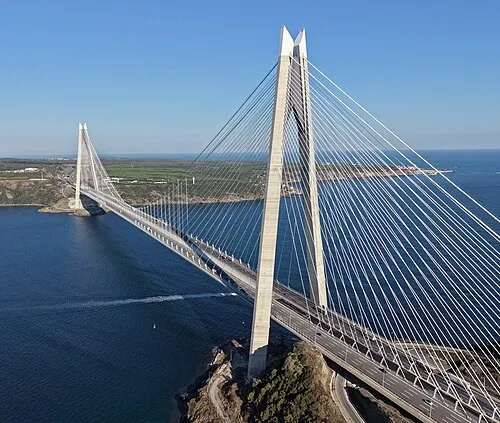 Yavuz Sultan Selim Bridge Landmark, Sarıyer3.7 km NE
Sources & licences
Data last updated: · 2 independent sources