Çiğli District
Located in İzmir Province, Turkey Coordinates: 38°29′17″ N 26°57′57″ E
- Population
- 214,065
- 214.1K
- Elevation
- 3 m
- above sea level
- Local time
- UTC+03:00
- Europe/Istanbul · UTC+03:00
- Places inside
- 25
- listed under Çiğli District
About Çiğli District
Çiğli District is a district. Location: İzmir Province, Turkey. Population: 214,065.
In comparison
- 5 sights and natural places within 10 km Eskigediz Mecrası, Yetmişbeşince Yıl Türk Dünyası Parkı
- Listed here: Neighbourhood: 23, City: 1, Natural site: 1
Places in Çiğli District
25 places-
Çiğli City214.1K
-
Ataşehir Neighbourhood28.9K
-
Küçükçiğli Neighbourhood21.8K
-
Balatçık Neighbourhood19.1K
-
Evka-Beş Neighbourhood12.7K
-
Yakakent Neighbourhood10.3K
-
Şirintepe Neighbourhood8.4K
-
Egekent Neighbourhood8.1K
-
Inonu Neighbourhood7.9K
-
Guzeltepe Neighbourhood6.4K
-
Ahmet Taner Kislali Neighbourhood6.4K
-
İzkent Neighbourhood6.3K
-
Esentepe Neighbourhood6.2K
-
Uğur Mumcu Neighbourhood6.2K
-
Çağdaş Neighbourhood6.1K
-
Sasallı Neighbourhood4.5K
-
Evka-İki Neighbourhood4.1K
-
Maltepe Neighbourhood4.1K
-
Aydınlıkevler Neighbourhood3.9K
-
Köyiçi Neighbourhood3.9K
-
Harmandalı Neighbourhood2.8K
-
Evka-Altı Neighbourhood2.3K
-
Ahmet Efendi Neighbourhood2K
-
Kaklıç Neighbourhood1.6K
-
Yetmişbeşince Yıl Türk Dünyası Parkı Natural site
Nearby attractions & nature
Everything nearby-
Eskigediz Mecrası River, İzmir Province5.2 km S
-
Ilıca Deresi River, İzmir Province10 km SE
-
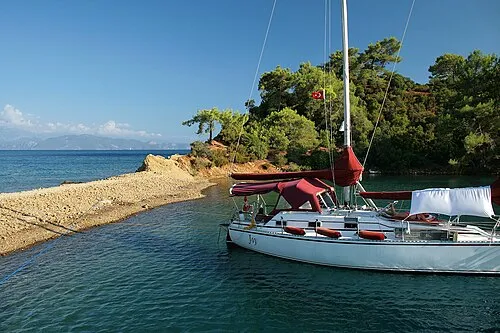 Saint John Island Island, İzmir Province17 km SW
-
Yeni Kale Fort (historical) Historic site, Narlıdere9.1 km SE
-
Dalyan Natural site, İzmir Province12 km SE
-
Saint John's Castle Historic site, Balçova9.3 km SE
Sources & licences
Data last updated: