Yağ Çayı
Located in İzmir Province, Turkey Coordinates: 38°23′04″ N 26°55′32″ E
- Elevation
- 2 m
- above sea level
- Local time
- UTC+03:00
- Europe/Istanbul · UTC+03:00
About Yağ Çayı
Yağ Çayı is a river. Location: İzmir Province, Turkey.
In comparison
- 10 sights and natural places within 10 km Onbeş Yıl Atatürk Anı Ormanı, Catalkaya Tepesi
Nearest towns and villages
-
Bademli Village, Narlıdere2.8 km E
-
Maltepe Neighbourhood, Güzelbahçe0.9 km SW
-
Liman Reis Neighbourhood, Narlıdere1 km E
-
Yaka Neighbourhood, Güzelbahçe2.5 km SW
-
Yalı Neighbourhood, Güzelbahçe3.2 km W
-
Güzelbahçe Bucağı Municipality, İzmir Province5 km SW
Nearby attractions & nature
Everything nearby-
Onbeş Yıl Atatürk Anı Ormanı Natural site, İzmir Province4.4 km SW
-
Catalkaya Tepesi Mountain, Narlıdere4.9 km SE
-
Dikmen Dağı Mountain, İzmir Province8.1 km SE
-
Çamli Deresi River, İzmir Province6.3 km W
-
Eskigediz Mecrası River, İzmir Province6.9 km N
-
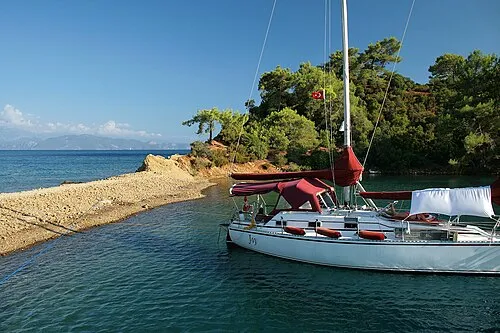 Saint John Island Island, İzmir Province12 km W
-
Koca Tepe Mountain, Urla İlçesi10 km SW
-
Aykavuştu Dere River, İzmir Province9.3 km SW
Sources & licences
Data last updated: